

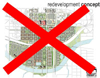
You should be able to click on it and get a bigger version if you need. But in all, I feel like this is a much better proposal for how to do C2S than what we currently have. The key differences I think are that the green space is continuous, the boulevard is a little toned down, the convention center is moved to its own little district by the head of the Bricktown Canal, the canal extension follows Sheridan instead of cutting C2S off from the CBD, and it includes a streetcar route that cuts through the area. I think I also put a lot more emphasis on the concept of "live/work/play".
- The convention center being moved, I feel, is the most important change I made. I hate the current site because it creates an impenetrable cluster of superblock civic buildings all the way from Sheridan down to the new Crosstown. By moving it across Shields it's now right across the street from Bricktown and less likely to create a huge vacuum of normal live/work/play use in the heart of C2S. But I also didn't want to move the convention center and end up segregating it so that it doesn't feel like a part of the city, so I really gave it its own little mixed-use district, that is mostly going to be geared toward hospitality, but deeper in will also include residential. I felt like it worked out perfectly that the convention center and the new district built up around it will surround the headwaters of the Bricktown Canal, which connects it into Bricktown for sure and will end up creating interesting development opportunities.
- Another key change is the boulevard, which I aptly named Ralph Ellison Avenue, after OKC's famed author who largely gets no recognition from the community. The boulevard represents a compromise between one faction that wants a soaringly wide, amazing, landmark stretch similar to the Champs Ellyses in Paris, and another that is more pragmatic about the likelihood that such a soaringly wide boulevard would ruin C2S. I propose two simple one-way streets that are two lanes with side parking on the outside (so really 3 lanes wide) that are separated by a wide median. Effectively, it's one street--but it is separated so that there is a wide right of way that can be used to expand should the pedestrian activity ever guarantee that a wide avenue wouldn't be a flop..but at the same time I want it to be an important artery because it is the street that will take people all the way across the center city. Hopefully tourists and travelers will make the choice to take the exit and wind up back on the highway which will show off our awesome city. By having the median park, which would have benches, fountains, walking trails, etc, and keeping the vehicular streets narrow, hopefully the environment would retain walkability so that it isn't keeping the Mongols out or something.
- I also feel differently about how the park should be planned. I think it's completely stupid to have one block that's developed as a shopping mall separating the Myriad Gardens from the elongated Central Park. It's absolutely moronic in my opinion. I moved the shopping mall (which isn't really a shopping mall, but sorta-kinda) to where the convention center currently is and proposed another such major mixed-use development on the west edge of the park along Ellison, which I'll discuss more in detail later. The way I envision it, the closest expansion zone (which is currently slated as shopping mall) should most closely resemble the existing Myriad Gardens which was never finished. Here I would simply finish the Myriad Gardens with the things that I.M. Pei planned for it to have (say what you want about the misguidedness of Pei's comprehensive plan, the Myriad Gardens are the one great thing that we got out of it). Going further down across Ellison the park can exactly resemble the design proposed by the official C2S oversight committee. I have no problem with the amenities of the proposed park! It would be Central Park NYC mixed with elements of Millennium Park Chicago, but it would all be one cohesive landmark park all the way from across the Devon Tower to the shore of the Oklahoma River, but it would just be named the Myriad Commons.
There would also be a Central Park, but it would be much smaller, and less landmark. Central Park would be a small neighborhood-oriented park to build the parkside neighborhood around. It would still be a decently sized park though, but it would be much cheaper because it would require no interesting features. Just some walking trails and tons of landscaping would be perfect there. One idea I'd love to see explored a lot more in OKC is community gardening. Maybe they can fence off an area, or heck the entire park, and divide it into community gardens that people can rent as their own for a very small fee.
 The Bricktown Canal extension should go along Sheridan, and not the boulevard. Sheridan would still go through, but for those two blocks between the edge of Bricktown and the Myriad Gardens, which mostly passes the bulk of our little "hotel district", it would be one-way entering Bricktown. The west-bound side would be taken out and that's where the Canal extension would go. The existing sidewalk for Sheridan and Sheridan Avenue itself would be the walkways along it. This would be the easiest way to extend the Canal west, and as long as Sheridan can still provide ingress to Bricktown then it works out perfectly. A walkable and attractive right-of-way is created that pedestrians can use to perfectly navigate between the CBD and Bricktown, namely, from Bricktown restaurants to the Ford Center or other attractions, with existing hotels positioned strategically. Maybe the Century Center can even be torn down and developed with a new hotel along the extended Canal. Extending the Canal specifically down Sheridan, which would line it with hotels, the old convention center, the park, and Devon Tower, it's a canal that does a better job of holding a candle to the San Antonio Riverwalk.

 Other less key differences: I created a historic preservation area for Film Row (which doesn't deviate from the current plan, but I just felt like it should be included since the area borders the C2S impact zone) and also one for SW 3rd Street which does deviate greatly from the current plan. There are a lot of really awesome historic brick warehouses along SW 3rd that should be saved and converted to mixed-uses somehow. This zone would encourage that to be done. Also the streetcar goes down Walker, cuts across the park south of I-40 (although doing it at I-40 might be a better idea in hindsight), and then goes up the existing BNSF tracks where it will have stops at the new convention center, Bricktown, and northward from there. Along the river, south of Regatta Park (where amazing things are happening) I added a residential district that will have a boardwalk on the south end, and at the heart of the residential riverfrontage is a little monument park which would have statues and fountains and stuff.

South of there, there is a historic preservation district along SW 3rd. Brick warehouses that can be converted to lofts, light retail, coffeeshops, and restaurants. On the other side of this historic preservation area is a predominantly residential area that is dense, yet also quiet at the same time. This is actually intended to be a really upscale neighborhood centered around Central Park. Or Center City Park. Or something like that. The idea is that it is an upscale neighborhood built around a park that really reflects heavily on being in the middle of a cosmopolitan city, which is why I felt like naming it Central Park over the main park, which I wanted to have a more unique name that doesn't scream, "We're a midsize metro trying to replicate New York." Closer to the main park (on the east side of this district) is a more mixed-use area. The mixed-use zoning isn't to indicate mass new urbanist development, but more just that the street levels of all of the buildings won't be residential. They'll include stuff like bookstores, cafes, coffee shops, night clubs, maybe small bank branches, dry cleaners, fast food, etc. It will be the area where basic neighborhood retail is concentrated, but this area is still predominantly residential, and upscale, just like the western half of the district. Buildings for the entire area, from Western to park edge, will have a maximum height of 5 stories.
Across the Crosstown Expressway from the area I just described is a more middle class residential neighborhood that isn't nearly as mixed-use as the area fronting the Myriad Commons north of the Crosstown. There might be an occasional street level coffee shop or cafe, but here there's nothing wrong with street-level homes. This area is really dense, but also has a height restriction of 5 stories. The neighborhood is anchored by the community center proposed for the park and by the Little Flower Church. Maybe there could be some other churches, as long as the modern churches could build on a site that mirrors historic urban churches. South of 12th street is just an area (that is still pretty dense) that consists of single family bungalow homes with small yards. Imagine a modern Jefferson Park.
Across the park (on the SE side of the park) is a mixed-bag neighborhood. It's basically a mix between SW and NW parkside. It'll be home to both middle class, lower-middle class, and upscale, and it will mostly be a quiet residential-dominated neighborhood, with the exception that some blocks adapt to special environments. For instance along SW 10th Street where I proposed for the streetcar to cut through the park, is an area of moderate mixed-use development with uses that correlate to the massive new convention center, just up the streetcar line. The area is lined with hotels and mixed-use development, BUT it still tries to keep a subdued, mostly residential feel to the area. The subdued feeling ends at 5th Street where there will be mixed-use development along Ellison, right across from what will become the new front entrance of the Ford Center. I believe that this area should be heavily oriented around the Ford Center. Maybe include an ESPN Gameday, sports bars, and fan shops. The development will be similar to the Power & Light District in Kansas City, which won't be as dense as the development further west along Ellison, but it will still have an active and hectic feel with pedestrians all around and street parking near impossible to find. Maximum height maybe..3 stories tall in this area, but still dense, and no surface parking, which should go without saying. This gamezone area is the least dense area I've planned, but at the same time one of the busiest. The absolute KEY to this area is that Shields Blvd HAS to be redone! It needs to be brought down to the street level.
In the convention center district the idea is that this area is busy, absolutely hectic. I was worried that the convention center might dull down on days without conventions in town, so I put it across Ellison from Lower Bricktown and surrounded it with sort of a "Lower-Lower Bricktown". Hopefully the area is a hit. Ellison, the way I want it, will be very easy to walk across on foot, so the idea is for this area to basically be part of Bricktown. Or Lower Bricktown, at least. A key thing I want to mention about the convention center is that I put it on top of the grain silo for a reason. Everything that isn't colored blue can just be razed, but I would really like it if the City of OKC would preserve those grain silos and include OKC Rocks, grain silo and all, in the convention center site. The result could be a really cool contrast between OKC's roots and OKC's future and a design that is so creative and unique it becomes megalomania in the architecture world.
Across the Crosstown is another park-oriented neighborhood that is nothing special. The idea is that Regatta Park is going to become one of OKC's biggest and most important attracts, so I just wanted it to be very incorporated into the urban fabric, which right now it hardly is. On the east side the density starts up high and then turns into dense bungalows, similarly to on the across corner of C2S. The bungalows will back up to the existing Kerr McGee tower thingy that I forget what it is at the moment (because it is so forgettable). On the other side of Regatta Park is a denser, more middle-class neighborhood that probably is more influenced by being waterfront than parkfront. Along the riverfront is room for a corporate tenant to do something unique and modernist. In fact there are scattered nodes all along the riverfront in various spots, I think 3 or 4, that will be small corporate campuses, except for one big one at the Walker bridge. This is just to have a lot of architectural diversity along the river, considering that corporate campuses usually feature what's "cutting-edge" for the time, which at the present, is anything that looks LEED-certified. You won't get that from residential neighborhoods for the most part. There's a boardwalk where people can set up vending stands and stuff by the 15th Street bridge (which can just be gotten rid of IMO, as I was careful to make sure I didn't include it in my planning) and another pocket park along the river at 11th, which will just be a nice little square with fountains and statues and stuff.
Phwew! That's an exhausting overview of something different that we can do with C2S. Oh and last but not last, I included the Humphreys airpark redeveloment site (which will actually be the first of any of this to break ground), and I had an idea that the West Reno streetcar line might be able to be extended south along Western so that it could service what will be a major development here along the river. It might just be a better idea though to save that, not for the downtown streetcar circulator system, but for when its time to start on city-wide light rail (different from streetcar). The line extending south or whatever could pass it somehow. Just a thought.
Hope you all liked this, or read it at least. Let me know what you think!

3 comments:
Awesome plan, well thought out. I especially like keeping OKC Rocks, unifying the parks, and the SW 3rd preservation district.
Thanks Clay. I just think that the I.M. Pei wannabes don't know what they're doing, and forgot where the treehouse should go.
Awesome post, great job. I really like the moving of the convention center to E of Shields/RR tracks.
Post a Comment