Showing posts with label urban design. Show all posts

Tuesday, July 31, 2012

Do we make the news?

Well, I feel like Council went quite well today. Watch for us on the news! I know I myself may end up on News9 and KOCO, as I was interviewed by one of their lovely reporters as I was leaving council chambers. NewsOK's Michael Kimball was tweeting live, and he'll have a full wrap-up. No sign of KFOR - no offense to their viewing audience, but they're probably the least likely to cover something downtown.

edit: Here is the Kimball write-up, which was indeed quite favorable to the better boulevard. It's important that the factual record stress that the earthen ramp will hinder development, which we can all agree we need more of if we're ever going to keep up with demand for housing, etc.

edit2: News9 has their coverage of today up online, and it looks very good, congrats to News9 on a well-produced story. I was pretty surprised that I made the cut personally, as there's nothing quite like seeing yourself in high definition on the evening news. I think Wenger's bit is the most important, because it really shows the engineers coming around and beginning to think with more emphasis on planning's concerns, like walkability. Could we all be singing Kumbaya down on the Boulevard?

"The people in Oklahoma City have ideas themselves, and it's important for ideas to come from all kinds of diverse backgrounds," Nick Roberts said. 
Nick Roberts with Friends for a Better Boulevard says repeating mistakes from the past will keep younger generations and growth from OKC. 
"We've also seen this boulevard get designed in a way that's going to decimate the southwest side, we believe," Roberts said.
News9.com - Oklahoma City, OK - News, Weather, Video and Sports |

(Please forgive any self-congratulating on my part, I just hate public speaking, and I'm not used to actually sounding coherent on these news reels and at City Hall.) :P

edit3: We made KFOR too (including a snippet of me up at the podium), and I heard that we made KOCO as well. I'll stop here. But it was a good one-day media blitz for sure!

Monday, July 30, 2012

Opening Arguments


With tomorrow being the day for official Opening Arguments on the ODOT Boulevard fiasco, in which ODOT wants to build an $80 million boulevard, the reason for the exorbitant cost being a large earthen ramp section of elevated freeway that will carry the boulevard over Reno, Classen, and Western avenues on the western edge of downtown. The mission of urbanists and government watchdogs is simple: To prevent this misuse of funds and redirect it instead to something that improves downtown, rather than damages it.

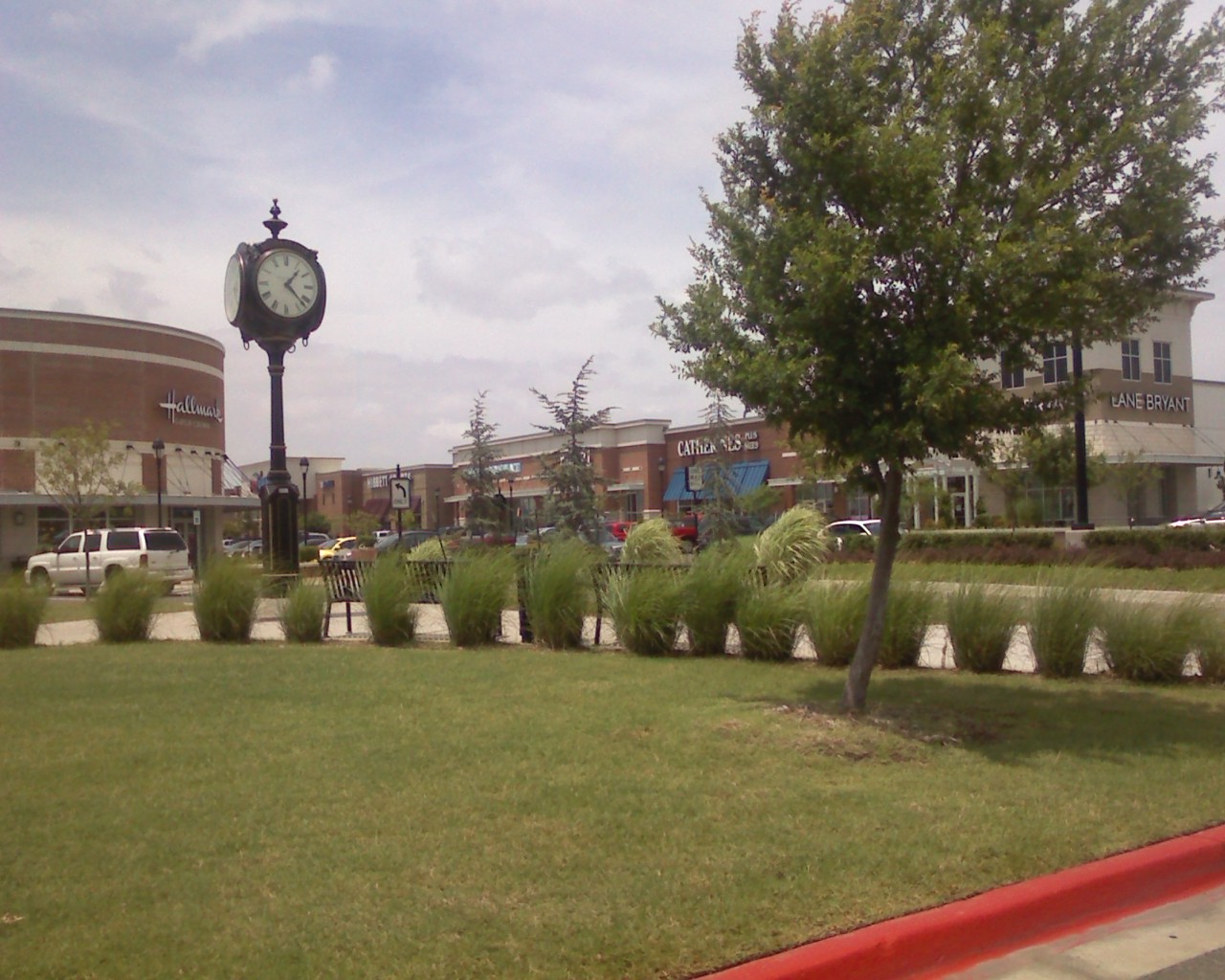
Downtown is important - it is where the majority of Oklahoma City's GDP is generated, it is the cultural and entertainment center of our metropolitan area, it is where young professionals moving to our city want to live, and it is the basis for the overwhelming majority of OKC's positive appearances in the national media. For fear of redundancy, allow me to stress that ODOT's earthen-ramp suburban freeways are not the basis for OKC's positive appearances in national media. Before I move on to the next point, here it is only fitting to conclude that ODOT must treat downtown uniquely from how it treats every other roadway in our state, which is shameful enough. This means that downtown, we do not need a new freeway where one was just removed, and those at-grade roadways need to be conducive to pedestrians, bicyclists, school children, Thunder/concert crowds, and just life in general. 

People live well downtown, and it shows - when you see people on a leisurely morning bike ride, or running an errand on the new OKC Spokies bike share system, walking their dog through Bricktown, or the throngs of people enjoying evening drinks on rooftops scattered across downtown. Whether or not these folks have a downtown address yet, these people are living their lives downtown - and that has been a very good thing for improving OKC's reputation over the last decade. These people do not need their lives disrupted by a new elevated, earthen-ramp freeway. Downtown's growth potential does not need to take a hit so that ODOT can move more cars than ever, faster than ever, during peak periods while the road sits empty all other times. Or more likely, downtown's future development does not need to be stunted just so that someone with ODOT ties can get a payoff as is common with their road projects. OKC's national reputation does not need to take a hit from building a misguided freeway downtown. All ODOT is doing is inducing traffic, rather than solving it, with their "our way or the highway" mentality of forcing highways on cities and refusing to even listen to other disciplines that have had considerably more success in combating traffic problems. 

This is why it is so important for a, urban planner, even if it's just one planner up against a cartel of public engineers, to have at least a say in major projects that will shape downtown for decades to come. That has not happened here. Not a single urban planner, or for that matter anyone not a public engineer, has been involved in this process.

Hello, this is ODOT, and we're going to build this highway
It all started back in 1998, when I was still a kid growing up in OKC, when City leaders first learned of ODOT's plans and tried to abate them then. Anyone wanting to know more about the timeline of how this came about, Steve Lackmeyer wrote an excellent context piece here complete with a flashback write-up that he did after ODOT chose the route in 1998, concluding with a tidbit on then-ODOT chief Neal McCaleb's disdain that the press would show up when he selected the route. McCaleb tried kicking Lackmeyer and his colleague, Jack Money, out of the meeting to no avail, and ended up settling for biting comments for public transparency. This is ironic because ODOT has predicated their insistence on the already-chosen route and proposal on "fulfilling a promise" (more like a threat) to OKC leaders back in the 90s. Even if their mumbojumbo was accurate about "fulfilling a promise," that still seeks to exclude all of downtown's growth, all of OKC's new residents, and all of OKC's <30 young professionals. When new residents and young professionals are so excluded from the public process, they are significantly likelier to move somewhere that they feel more appreciated. This is a fact backed up by studies. Yes, we should have known the boulevard would happen like this, however, we had a mayor who also lied to us when he told us the whole thing would be at-grade and conveniently excluded that Western/Classen/Reno intersections would not be. However this isn't about egos or getting the record right; This is about getting the finished product right.

Then there was the EIS. For those who don't understand public engineer jargon, the EIS is the environmental impact statement, which is required as a part of the FTA grant process (getting road projects funded federally). The EIS is supposed to outline the project scope and its impact on the surroundings, and is supposed to be finalized before the project may commence. Below is the text of the I-40 Crosstown Relocation EIS; Sections 3&5 are relevant to the Boulevard project:

3.0 ALTERNATIVES CONSIDERED"This chapter describes the alternatives and summarizes the evaluation process."3.4.1 Tier One Evaluation3.4.2 Short List of Build Alternatives RefinementAlternative D"A six-lane at-grade boulevard would be constructed in the existing I-40 right-of-way from east of the Union Pacific tracks at the I-235 interchange to west of Walker Avenue; however, from west of Walker Avenue to Western Avenue, the existing I-40 bridge structure would be rehabilitated. From Western to Agnew Avenues, the existing I-40 facility would be converted to a divided boulevard."3.4.6 Tier Two EvaluationProject Construction Time and Implementation Difficulty"Alternative D’s Phase I construction would achieve the full traffic flow benefits projected for Alternative D because only the boulevard construction would remain for Phase II."Access to Downtown"The proposed boulevard from I-235 to Agnew Avenue will provide improved access to Bricktown and the downtown area from eastbound and westbound traffic."3.5 Preferred Alternative"As a result of the Tier-Two evaluation, the ODOT selected Alternative D as the locally preferred alternative because this alternative provides a ten-lane facility approximately 2,200 feet south of the existing I-40 alignment and involves converting the existing I-40 facility to a downtown business route. This business route would maintain the current at-grade freeway from Agnew to Western Avenues and bridge structure from Western Avenue to west of Walker Avenue and reconstruct the existing I-40 facility from west of Walker to I-235 as an at-grade six-lane boulevard with at-grade intersections at the downtown cross streets."5.0 ENVIRONMENTAL CONSEQUENCES"This chapter presents potential beneficial and adverse social, economic, and environmental effects for the proposed relocation and construction of the I-40 Crosstown Expressway..."5.2 NOISE IMPACTS AND VIBRATION ANALYSIS5.2.a Traffic Noise"The FHWA has established the Noise Abatement Criteria (NAC) for various land use activity areas that are used as one of two means to determine when a traffic noise impact will occur.""When a traffic noise impact occurs, noise abatement measures must be considered. A noise measure is any positive action taken to reduce an activity area’s traffic noise impact""Alternative D’s boulevard alignment was modeled at 45 mph from Robinson Avenue to Classen Boulevard and at 60 mph from Classen Boulevard to Agnew Avenue.""As shown in Table 5-5, the projected noise levels with Alternative D would approach, equal, or exceed the receptor activity categories B and C’s NAC; therefore, this alternative would result in traffic noise impacts and mitigation measures must be considered in accordance with the 1996 ODOT Policy Directive, “Highway Noise Abatement.” This policy states that mitigation will not be considered for commercial or industrial areas or for those areas that are trending to commercial or industrial land use."5.2c Vibration Impact Analysis"There are no federal or state standards or regulations regarding traffic-induced vibration."5.3 LAND USE IMPACTS"The existing I-40 facility between the I-235/I-35 interchange and the Agnew/Villa interchange would be replaced under Alternative D with a boulevard. The current at-grade freeway would be converted to a boulevard from Agnew to Western Avenues. From Western Avenue to west of Walker Avenue, the existing I-40 bridge structure would be rehabilitated. From west of Walker Avenue to I-235, the boulevard would be a divided, multi-lane, grade-level facility with at-grade intersections with major cross streets and this is where land use impacts would occur.""The boulevard's north side for the first two blocks west of the Burlington Northern and Santa Fe railroad would front the new indoor sports arena. The first block on the south side fronts an Oklahoma Gas and Electric facility and that use is not expected to change. The remainder of the boulevard corridor frontage will consist of over six linear blocks of vacant land and approximately seven blocks of commercial, industrial, and some institutional development on either side of the facility, including parking lots. Of the vacant land, most is zoned industrial, but one block is zoned residential, and another is currently unzoned since it falls entirely within the existing ROW. Transforming the existing facility to a grade-level boulevard with at-grade access to cross streets, would provide the incentive for commercial development on vacant land and, commercial redevelopment of existing industrial properties along the boulevard would increase. The least impact would be no change in existing land use and, no requests for rezoning if market demand were to be stagnant. The greatest impact would be commercial development or mixed commercial and industrial development on all vacant lands and possible commercial redevelopment of existing industrial properties. This would require rezoning currently zoned residential and industrial properties. The current commercial zoning along the north side of the proposed boulevard between the sports arena site and Hudson Avenue is consistent with the ULI’s “Downtown Oklahoma City” plan. Those two blocks are within the plan’s designated downtown entertainment district. Similar development along the south side of the boulevard would also be consistent with the plan, given the area’s designation as a “flex” district, which is designed to capture expanded downtown development. North of the boulevard and west of Hudson Avenue, the ULI plan designates residential, loft apartment redevelopment of appropriate commercial warehouse structures. The land fronting the boulevard in this area includes vacant lots and is zoned for industrial uses. Market incentives and planning and development policies could guide new area development and redevelopment, rather than the expected commercial development. The overall effects of converting existing I-40 to a boulevard could have positive land use impacts on the downtown area."5.5 HISTORIC AND ARCHAEOLOGICAL PRESERVATION IMPACTS"Developing a grade-level boulevard serving the downtown area along the current I-40 alignment would change the SW 3rd Street Industrial District's visual setting. The change may bring the district closer to the original historic context, which included grade-level city streets. Therefore, this is anticipated to be a beneficial impact. Impacts to other historic resources would not be likely."5.14 JOINT DEVELOPMENT"ODOT recognizes the strategies identified in the City of Oklahoma City's land use and mitigation plan for implementing Alternative D. Alternative D would provide access to Bricktown's south end and downtown. Also, the urban boulevard would provide additional access to potential development sites between Walker and Western Avenues."5.15 CONSTRUCTION IMPACTS"For Alternative D, improving the existing alignment to a boulevard is scheduled after the new facility is completed. Vehicles crossing I-40 along this section would experience occasional delays or be directed to alternate crossings."5.18 VISUAL IMPACTS"Adding a street-level boulevard along the existing raised facility would also shorten the visual distance between the Riverside neighborhood and the downtown."5.19 PEDESTRIANS AND BICYCLISTS"The boulevards associated with Alternatives B-3 and D offer the opportunity for east-west bicycle and pedestrian travel, as well.""Alternative D would include converting the existing alignment to a landscaped boulevard. This proposed facility was analyzed for its impacts to non-motorist activities. Crossings, which would merit attention as possible bicycle routes, include the same facilities as for Alternative B-3 (Agnew, Pennsylvania, Western, Walker, and Robinson Avenues and Shields Boulevard), with the addition of Reno and Classen. The facility would cross the Bricktown Canal Trail, but would present no greater impact than the existing I-40 facility. Using the I-40 ROW as a boulevard would have slight or no impact upon non-motorist access to nearby public schools. The current alignment is a boundary feature for Capitol Hill, Wilson, and Shidler Elementary School feeder areas, which means that students attending these schools should not have to cross the boulevard. The boulevard alignment is a prominent feature in the Mark Twain Elementary School feeder area. Although changing existing I-40 to a boulevard would result in a less imposing physical barrier for non-motorists, a boulevard would present greater opportunities for non-motorist conflicts with motorists than the present limited-access configuration. These conflicts could be minimized by using signalized crosswalks to allow non-motorist crossings without vehicular turning movements. Other possible safety measures include bicycle lanes, intersection design with places for pedestrians to stand at street corners and on the median, all-way red lights for pedestrian crossings, and raised crosswalks where larger pedestrian crossing numbers are anticipated. Because other existing pedestrian and bicycle activity centers, including downtown, the Myriad Center, and the Bricktown District, are concentrated north of the existing I-40 alignment, using the present I-40 alignment as a boulevard would divert vehicular traffic away from these non-motorist activities and result in improved safety. The bicycle/pedestrian impacts of the proposed boulevard along the present I-40 alignment would likewise depend upon the ultimate facility design. While a boulevard potentially would represent more opportunities for non-motorist conflicts with vehicles than a controlled-access highway, abutting boulevard land uses and facility design would also be important considerations. Facilities that attract special-event, tourist, shopping, and cultural activities, would necessitate slower speeds and painted and signalized crosswalks. Additionally, where warranted by the pedestrian traffic levels, elevated crosswalks should be considered. Through traffic will be encouraged to use the new I-40 alignment."5.23c Economic Impacts"The property tax base in the affected study area could be enhanced by potential commercial development and redevelopment in available areas along the proposed boulevard under Alternative D."5.24 ADDITIONAL MITIGATION"Downtown access concerns have been addressed by identifying three boulevard options associated with Alternative D. These options included maintaining the existing I-40 facility; constructing the six-lane at-grade boulevard from I-235, east to Agnew Avenue; and providing a modified boulevard combining the other two options. The preferred option is the modified boulevard that provides a downtown business route. This option involves retaining the current at-grade freeway from Agnew to Western Avenues and bridge structure from Western to west of Walker Avenues and reconstructing the existing I-40 facility from west of Walker to I-235 as an at-grade six-lane boulevard with at-grade intersections at the downtown cross streets." USDOT - RECORD OF DECISION"The decision is to select the preferred alternative, Alternative D, as described in the FEIS.""The selected alternative will provide a six-lane at-grade boulevard in the existing I-40 right-of-way from east of the Union Pacific tracks at the I-235 interchange to west of Walker Avenue. From west of Walker Avenue to Western Avenue, the existing I-40 bridge structure will be rehabilitated. From Western Avenue, west to Agnew Avenue, the existing facility will be converted to a divided boulevard."
In case anyone is confused by all of this jargon, I highlighted the parts of the EIS that are incorrect and in need of updating. Why is this relevant? Why does any of this matter? Because ODOT is claiming that they can not do an at-grade boulevard all the way to Western because they have to fulfill their obligations in the EIS, not that this has ever mattered before for ODOT (they broke the hell out of the EIS for I-235 in their quest to demolish downtown's black community, Deep Deuce, in its entirety). So not only is the moral of the story that ODOT lies, but also that ODOT expects us to not read this stuff, to just go away eventually, and let them get back to their work. The most glaring omission is the fact that the old Crosstown viaduct no longer exists, and therefor it is not possible to "rehabilitate the existing bridge structure." The EIS needs to be redone anyway, and this is hardly an impediment specifically to changing the plans to make them more urban. If the EIS has to be redone, causing delays on the project that will be justified to get it right, it will not be because OKC demanded a Better Boulavard, but instead because the Feds decided to reign in ODOT which has a long, storied history of breaking these documents. But it's okay ODOT, Mick Cornett and Eric Wenger also have a habit of telling lies.

Furthermore, they conclude that the boulevard has little impact on schools because it is nowhere near any schools. This is inaccurate as well due to the construction that will begin next year on the new Downtown Elementary which will back-up to none other than the BOULEVARD. Nowhere near any schools, right.

Opportunity squashed
Due to the new I-40's only downtown exits being at either Shields/Robinson or a full exit at Western Avenue, where the majority of people entering from SW or NW OKC come into downtown, Western Avenue is now the front door to downtown. It is our less-than-grand entrance to downtown. Blighted for blocks, congested and jammed like no other city street at 5 o'clock, Western has traffic counts to make development happen - all of those downtown workers taking Western to get on the highway heading home will stare at whatever properties line the ROW, so they might as well stare at redevelopment.


The group, Friends for a Better Boulevard, of which I am certainly informally a part of, has envisioned a grand entrance to downtown where people currently sit in traffic along Western. They are proposing the Market Circle, along the Boulevard at the Reno/Classen/Western intersections, and the Thunder Circle, along the Boulevard in between the Chesapeake Arena and new MAPS3 Downtown Park. In the Market Circle the pro-bono architects have envisioned an arch way that gives OKC the opportunity to realize a turn-of-the-century plan by legendary architect Solomon Layton (State Capitol, Colcord, Skirvin, et al.) to have a Veterans Memorial Arch in the middle of Lincoln Boulevard. Those plans, along with the Capitol dome (a bad idea) were never realized. However, often the best new plans incorporate good old ideas, that came about for a reason. This traffic circle proposal will catalyze a boom of dense development west of downtown and generate significant economic development for OKC. Here is an excerpt from a recent article by Lackmeyer on Film Row and west downtown's development boom (this quote is Film Row redeveloper Chip Fudge talking about several building projects and predicting that south of Film Row will be a hot spot):


With all this activity, and Devon Energy Center in the foreground, friends are no longer mocking Fudge for plowing his money into “skid row.”
“Life is good,” Fudge said. “My friends who thought I was nuts for doing this initially now think I'm brilliant. Really, I'm just lucky. We're continuing to buy property in the area. And if the boulevard (planned along the alignment of the old Interstate 40) goes in at ground level as I expect, I think the area south of here will be the next hot spot.

Read more here.


There is also the matter of the Farmer's Market, which is what lies south of Film Row, and concurrently the city and a group of citizens are trying to revitalize. Currently it has been repurposed as an events center taking advantage of its beautiful mission-style architecture, but there may be plans in the future to bring back a permanent outdoor market and engage historic redevelopment in this area. The Farmer's Market is an extremely historic center of commerce for OKC, and my own grandfather used to work there long ago. In fact, back then, the entire clan worked there selling produce which was not a bad living back before WWII. The Farmer's Market was a magnet of middle class life in Oklahoma City back then, just as the once-beautifully landscaped Canadian River waterfront was with Wheeler Park and Delmar Gardens. This market-area masterplan seeks to bring back both the tranquility and the commerce:


Unfortunately for ODOT, all of these are things we are not willing to sacrifice just so that ODOT can pay somebody off and move on more easily to the next project. All of these visions, especially the hope for a grand entrance into downtown, and also the hope to revitalize the areas south of downtown such as the market area and the riverside, are all endangered by this elevated freeway plan. This is also a plan that was most recently articulated by highway engineers who weren't aware that the streetcar would run on rails in the Boulevard. How do you get through to these people, as oblivious as they are, aside from political means? At the state level it is time to pursue correcting and reforming ODOT, but in the interim, at the civic level, we have to engage to protect our city and any other plans ODOT simply isn't aware of.

Those seem to include the Downtown Elementary, the Downtown Streetcar, Farmer's Market revitalization, Core2Shore revitalization, Film Row/Arts District redevelopment, and the very idea of downtown development on the whole. All of these ODOT is either ignorant or hostile to, and all of these kinds of projects have proven to be the essential ingredients in the recipe for an OKC reborn. What does OKC reborn mean and why is it important? Because too many of us remember a river that had to be mowed, too many of us remember wrestling and minor-league arena football being the main attraction in town, too many of us remember Wal-mart being the only place to shop, and too many of us remember an OKC that was essentially no more than an extended truck stop between LA and Chicago. Today those are merely insulting reminders of how far OKC has come in its quest to justify itself as a "big league city" and even cast itself in similar fashion to truly "world-class cities."

The ODOT earthen ramp is not world-class, hell, it's not even bush-league. It is embarrassing. ODOT has pushed OKC around too much for the last two decades, and it's time for OKC to take a stand. They bulldozed all of Deep Deuce, the downtown black community, and built a suburban depressed freeway (I-235) where there used to be a dense, urban neighborhood. They forced the I-40 Crosstown Relocation against the city's will. Then, they decimated the railyard behind Union Station which will add billions in cost when we get around to building the commuter rail that is planned, which the city idly watched them do, while a few enraged citizens went away kicking and screaming (Tom Elmore). Now they are taking our best site for urban redevelopment and giving us a highway mound of dirt and grass that will have to be mowed while it isn't dead and brown, like grass all over Oklahoma.

This isn't the revenge of Tom Elmore. This is the culmination of ODOT's years-long recent legacy in Downtown OKC, and a decision that needs to be made whether we want to hear only ideas that come from highway engineers or if urban planners should also be brought into the fold. Urban planners and design specialists, being the folks who gave us entertainment in Bricktown and large-scale gentrification in what was left standing of Deep Deuce, Automobile Alley, and Mid-town. Today these areas are surprisingly decent and growing better with each new development, despite the unfortunate past these areas have endured until now. The choice seems pretty simple.

Wednesday, July 25, 2012

Paging any planners

One thing had me wondering about the proposed Boulevard plans. Has there been a SINGLE individual with a degree in urban planning, regional planning, urban design, environmental design, etc. (ie., anything BUT civil engineering) who has said that the boulevard should be elevated? Can anyone name someone? Anyone? Just one person??

(Of course that's a rhetorical question, because we're referring to a boulevard that has only come about through sparse cooperation with ODOT and OKC Public Works.)

How can we make such a major decision in our city planning without input from a SINGLE individual who actually has a degree in anything planning or design-related. The thought of the elevated boulevard is repulsive. The thought of such major decisions, not just failing to include, but actively patronizing those who do have planning or design expertise - that goes beyond this boulevard, and is a much more serious issue.

Something is rotten in OKC right now. Very rotten.

Friday, July 20, 2012

Roundabout reservations

Many readers and folks beyond know that I've become one of many side advocates of Friends for a Better Boulevard, and I support almost everything that has been said by Bob Kemper and others that have gotten very entrenched in that fight for a better boulevard for OKC. That said, I concede that I was erroneously espousing the term traffic circle when what has really been envisioned is a roundabout, and there is apparently a very major difference between the two.

To paraphrase, a roundabout is a perfect circle where entering traffic yields to everything else and exits right to leave the circle. A roundabout is more of an orbital intersection, less of a perfect circle usually, where the lanes flow out and staying in the roundabout requires left turns. Roundabouts can efficiently handle a large volume of traffic but can not safely accommodate pedestrians, whereas traffic circles are the opposite.

Here is a chart created by WashU and distributed by Friends for a Better Boulevard (click to enlarge):


This looks fine and dandy, but I think it raises questions as to which of these we really want. I agree that this intersection will have to handle large volumes of traffic, but I am uncomfortable with it doing that unless major design concessions are made to promote walkability in and out of the circle as well. Why would we put an arch and a park in the middle of this, just to improve the view that motorists have, esp if people can't get to it?? I'm wondering if there is a way to engineer a hybrid roundabout and traffic circle.

Let me make one thing clear before I even open up this can of worms, and before anyone accuses me of straying from the reservation: I support whatever the consensus alternative is to anything above-grade. I just also agree that this debate needs to play out. For instance, while I love the amazing renderings produced by Andrew Stewart, who has also been helping the group, the bone I have to pick there is that Western Avenue does not flow into the circle. For me, Western Avenue and its high traffic counts, high prominence, high blight factor, and huge rent gap potential for development, is one of the main reasons to do this intersection RIGHT. I want to be on the record supporting the movement in its entirety and I support whatever a public process would yield, that said, I am looking to see Western Avenue flow directly into a circular roadway that can also accommodate pedestrians. A circle of some sort that does not accommodate Western OR pedestrians is only half as sweet.

Having made my unconditional support clear, I keep going back to the name "better boulevard." To me, a better boulevard means something other than the strict and narrow purview of what is better for motorists. I am looking for what is better for pedestrians, for bicycles, for transit, for quality of life, for the environment, for economic development, and the entire city as a whole. While there is no doubt that a roundabout is far superior to those ends than an earthen ramp or anything above-grade, I would also suggest that an old-fashioned traffic circle may be even better. IF there is a way to make a traffic circle work for high traffic counts.

Thursday, June 21, 2012

Western Avenue gridlock

Stuck in traffic for a good 20 minutes on that half-mile stretch of Western Avenue between Sheridan and the new I-40, I made a mental note to myself to revisit a post that I made a while ago. Western is routinely gridlocked during this half-mile stretch, and I myself was surprised that the new I-40 project's completion has actually finally given OKC the "big league city" rush hour that we all craved. Ok, or not..

However I think that this is an opportunity, not a problem (although trying a different synchronization pattern with the lights along Western may be a good idea to ease traffic circulation). It's an opportunity because these kinds of traffic counts don't exist anywhere else downtown, and even though Western is definitely the blighted back entrance to downtown, at least with this kind of bumper-to-bumper congestion and the corridor's newfound prominence, that lends a majority opportunity for the Market Circle proposal to take advantage of.

I happen to believe (call me crazy) that development should follow traffic counts, rather than try to magically manufacture them. Western must be redeveloped, the gridlocked rush hour traffic that only exists here is screaming for it. Imagine the exposure that a business would get if somebody is stuck sitting in their car for 5 minutes just in front of that business alone. Then gets to crawl up another hundred yards after a few lights turn green, and gets stuck for another 5 minutes staring at a different business. I think this is the kind of traffic that could actually make downtown destination retail (ie., another subject we've talked to death on here and around town) very viable, although as far as that goes I am still bullish on North Broadway and the A-Alley area, especially if they can get a public parking solution.

Here's the photo from NewsOK that shows you what Western becomes every single weekday between 4:30 and 6.


I think at a certain point, you have to stop basing your planning on how you understood downtown in 1990. Downtown has changed and evolved since then; downtown is dynamic. The new reality in 2012 is this. Take advantage of that new reality.

Tuesday, June 19, 2012

Market Circle renderings are IN!

Without saying a lot (I'll let the renderings, just completed by OKC Talk's CuatrodeMayo aka young architect Andrew Stewart, do the talking), I will just say that I think this marks the evolution of Friends for a Better Boulevard as one of the most dynamic local movements in recent history, perhaps second to only the Modern Transit Project. Could Andrew be the traffic circle's Jeff Bezdek? I doubt he wants that kind of commitment, I know I would be freaked out, but I also know that Andrew is very committed to seeing OKC evolve into the kind of community he and his young family can prosper in.

Please, click on these renderings to enlarge to full-screen, they're worth it:


Wednesday, June 13, 2012

The stakes

Higher than any poker game we've played lately..


So you've heard..

Great mention for the traffic circle movement on Kurt Hochenauers Okie Funk blog (Kurt used to write for the Gazette, idk if he still does) today - really summarizing what a movement this has become, with MAPS3 transit subcommittee members lending their support and enthusiasm for this city, myself, former ODOT engineer and consultant Bob Kemper really leading the charge, Councilman Shadid getting behind the idea in a big way, OKC Talk is buzzing about the idea, and so many more people. This is truly evolving into an organic preemptive strike against a huge blunder that is about to be made.

What really needs to happen is ODOT needs to wash their hands of this project and just give the funding over to the city and let the city do whatever it wants. I don't think ODOT is actually on a mission to screw up downtown OKC - Bob thinks they are concerned about going over budget and the city not wanting to maintain something. The solution here is easy, there is significant extra funding that the city has from the 2007 GO Bond Issue, and ODOT can just give the $80 million for the boulevard to the city and not worry about any more cost overruns (although that clearly wasn't a problem for them with the new I-40, which ran 3 times over budget and still isn't a depressed roadbed, just as they knew it would all along). There is also an extra $30 million in MAPS3, in addition to contingency funding there (that will likely go to the convention center when it comes in way over budget).

Anyway, here's the latest illustration that I have come up with for how this roundabout could potentially fit into a grander scheme.


I'll just add that this is also a work in progress, and definitely stay tuned. There's something else that we're going to roll out here in a few days, and we're hoping that we have a proposal that the entire community can really get behind, regardless of whether you want a premier center city or not. I've always believed that OKC can so easily be a first-rate center city, the bones are there, it just takes everybody realizing it and getting on the same page - which unfortunately is so much easier said than done.

And yes, my "grand scheme" for a better boulevard definitely involves moving the convention center to a location that is better for everyone, but that's not what this is about. This is about the roundabout, I just happen to take a holistic approach involving the entire boulevard. What happens west of Lee Avenue, in my mind, affects everything to the east.

Let me close by saying that I absolutely believe that everything in my illustration above can be accomplished with funding already committed - including MAPS3 funding, including 2007 GO Bond funding, including ODOT's committed funding, and including private funds that people have proposed going toward cultural institutions and private development. For those who don't know, the Kirkpatrick Foundation is moving the City Arts Center downtown, just not anywhere near the Arts District which I think is an unfortunate oversight of synergy, which is so important for the arts - and Fred Hall among others did talk about a major private development replete with mixed-use and high-rise residential (possibly the largest mixed-use project in state history) on the site that is now taken by the convention center.

Why can't we piece these things together from the perspective of what creates the most impressive, healthiest boulevard corridor, rather than what creates the best convention center? There are more important things than just a convention center, in the grand scheme of city planning. This boulevard, if we do it right, has the potential to pay dividends for OKC in terms of postcards, private development opportunities, and civic pride. Let's do this the right way.

Thursday, February 10, 2011

Planning curriculum in the schools

How innovative..to allow school kids to take a hands-on approach to the lessons they learn in class and apply them to the environment they live in. The Sun Belt desperately needs this.

Tuesday, September 7, 2010

Real infill coming soon

I think that phrase best explains the state of downtown development at the moment, which is actually significantly improved from last year when we were just losing major projects despite any anticipated boost from Devon Tower. Today we are better off in terms of knowing exactly what we've lost, how to come back from it, and the difference is we've come a long ways lately in gaining infill momentum. None of this is new news because you all have already seen it in the news and on the other blogs, just haven't gotten my take it due to my inactivity on here lately.


Think of Devon Tower, first and foremost. Hardly infill, when trying to analyze and assess the tower's impact on downtown, it will be equal or greater to the Ford Center or the Brick. I'm not even sure if we have a public works project downtown yet that is on that level. Maybe more on level of if Jerryworld were in downtown OKC, just call it Larryworld instead. What I can't impress enough is the importance of infill projects because they form the base of an urban environment. You can do without the major projects, you can't do without infill--right now we really do lack infill compared to the major projects in the works right now. To illustrate this problem, just think of the Deep Deuce area which is riddled with vacant lots with the downtown skyline towering overhead. It leaves an awkward impression of an urban desert (I don't know how else to say it). We have and without more infill will continue to have streets surrounded by mudpits and dried up dusty fields in the middle of our downtown, and clearly despite how wonderful that skyline is, the street-level is lacking.

There is a real need for a skyline, as it is a city's visual representation and I do believe it is important for a city's urban environment to form this representative image of that city. There is also a real need for facilities like convention centers and stadiums, because there aren't many other ways to pack that many people downtown at once--that traffic generated is much needed. However neglecting the infill projects, which are your less sexy, more practical, smaller buildings that form the surrounding neighborhoods--that's neglecting your meat and potatoes. OKC truly has a starved urban landscape if you look at it that way.

The reason I bring up Deep Deuce's vacant lots is to transition into what we've gained. Deep Deuce development is continuing to evolve continuously. Since the sky was falling downtown (last year), construction has picked back up at The Hill. Evidently they are just finishing up on the units on 3rd backing up to I-235, but they've also cleaned up the rest of the construction site which had weeds growing up everywhere. They will wait for the units to sell before starting on others, and amazingly, they have sold several more. I still think it's the worst bang for your buck downtown, but I sincerely wish them the best of luck for the sake of Deep Deuce, and hope that anyone looking for suburbia in downtown check them out.

Obviously the new Aloft Hotel, which I've already posted on a few times, will be major. It will compete directly with the Hampton Inn for business travelers looking for a very urban, chic hotel that they can use their corporate account on (which is where chains are good to have). The Aloft Hotel will have an advantage in competing for these travelers just because the brand image is more in line with this specific location, as opposed to the Hampton Inn which usually aren't that chic. The design is obviously going to be stunning and will create some real linkage between Deep Deuce and Bricktown.


The best project that's come onto the radar of late is a joint effort by Wade Scaramucci and Richard McKown, of Ideal Homes--an entire block bounded by Walnut, 2nd, 3rd, and Oklahoma--that will soon become 227 units with parking in the middle of the block and street level retail lining wide sidewalks. I think that the design could be anything and the product could be anything, there are just two things that are key here: This project, just like the Aloft, is financed and ready to break ground on an expedited construction schedule; and also, the project takes the last full vacant block in the Maywood Park area and turns it into the stuff cities are made of. Surrounding this contemporary apartment development on all sides will be the old Walnut Avenue Baptist Church, the Maywood Park Lofts, Maywood Park Brownstones, and the Aloft Hotel.

Deep Deuce's urban fabric resembles a horse shoe of development going around the edges that is finally being filled in, and it will be a continuous urban neighborhood from the BNSF tracks all the way to 235.

Elsewhere in Deep Deuce, Sage is also once again reinventing itself with the addition of a jazz club--returning the Deep Deuce neighborhood to its roots as a jazz hotbed. Good downtown development is not a lot of shiny new-urbanist projects sparsely scattered throughout greater downtown. When you create synergy from projects that relate to each other, bound each other, and create atmosphere is when you have good downtown development. Such as the perspective looking down 2nd Street at the new Maywood Park apartments and then the lofts fitting snugly with an equal setback, with the skyline rising over. That's the infill we need, focused where it most makes a difference right now.


And to bring it back in terms of Devon Tower, at what point with all of these major projects, do you have enough infill that there is balance? It may not even be possible. There are several billions of major projects in the works at the moment. Something like Scaramucci and McKown's apartment complex creates as much street-level density as Devon Tower despite being a miniscule fraction of the cost, possibly $10-15 million at the most probably, compared to $750 million. Maybe we don't deserve Devon Tower and perhaps it is "too enormous" a project for OKC, but we sure will take it and be glad to have it, but it does make you wonder what the right proportional amount of infill is that it should trigger?

Tuesday, August 17, 2010

Welcome to St Louis

I was asked the other week by the owner of urbanstl.com to write a blog post for them, so I thought I'd might as well include it on here too. This is going to be written from the standpoint of a few things that struck me as odd about my recent urban safari through St Louis as well as some things they're doing very well that my city of OKC could learn from. I think the positive outweighs the negative clearly, so OKC readers should listen up.

DOWNTOWN


I think downtown St Louis is interesting because of how it lacks activity for the complete opposite reasons that many other downtowns are lacking activity. Most are said to be "dead after 5." Downtown St Louis is largely "dead until 5." I think it's a good problem to have, because what can happen after 5 in downtown is a lot more interesting than what can happen after 5. I think the convention center seems to be well-done and well-integrated with Washington Avenue. Wash Ave is the main loft drag through downtown, and is lined with this impeccable streetwall that would be the envy of any city. The lofts go for about 1.5-2 miles or so and I knew I had to see it because I've heard it called one of America's best urban revitalization success stories that actually clearly differentiate urban revitalization from urban renewal. The CityGarden has been a successful urban park that has injected vitality into the downtown core, but it has yet to have been conveyed into vitality for the surrounding environs in the way that Millennium Park has caused land values along Michigan Ave to skyrocket.

The culprit? There appears to be many culprits. The most obvious to me seemed to be the lack of shade. An interesting alternative was brought up in discussion on the urbanstl.com forum that awnings should be used instead of shade trees, because of how it would compliment the existing building stock downtown. There seems to be a large local consensus that downtown St Louis has too much structured parking as well, with the idea being that downtown has become auto-centric. I don't think too much structured parking can be a bad thing, I just think it poses a challenge for downtown to address storefronts. Parking garages have a tendency to be blank walls or otherwise worse facades that inflict darkness on the surrounding environs. Parking garages are buildings none the less and should be looked at the same as any building and they may need city action to encourage renovations that make the street level more attractive and in some way interactive (shops, restaurants, etc). I liked this parking garage I saw in Streeterville as a good example of how a parking garage doesn't have to look like a parking garage.

But to sum up downtown, the bottom line is it was completely dead on a Friday at 4 pm at a time that most other downtowns would be jammed with people, even if that is the only time. There were no lawyers walking to the courthouse. No business men walking to a meeting. There were no residents out walking dogs. There were no people getting off work early. Downtown was totally void of typical signs of (business) life that still go on in corporate-dominated downtowns. Perhaps the underlying reason for slow daytime activity is lingering effects from job losses? Which, would defy the urban planner's playbook of cause and effect..

NEIGHBORHOODS

Neighborhoods are the pride of St Louis, which clearly is a city of neighborhoods. Virtually no other city that I have been to has done such a good job with neighborhood revitalization and restoration and preservation as St Louis--and even throughout the white flight, which this city has been hit harder by than most, has managed to preserve the ones that matter most, and that alone is worth major kudos. St Louis also ranks highly as one of the cities with the youngest residents living in the oldest buildings (interesting study I came across). What does that mean? It means that residents live an interesting and unique urban lifestyle that defines St Louis and sets it apart. Many neighborhoods have focal points which are usually a park (i.e., Lafayette Sq) or a main street drag (i.e., Cherokee St). Most all neighborhoods are well demarcated with entrances, gateways/archways, and especially street banners.

CONNECTIONS

Well, I said it is a city of neighborhoods, not a city of streets, or even connected neighborhoods. The very neighborhoods that are the strong point of this city all feel very isolated and disconnected for the most part. There is also a strong divide between the south side and the central corridor, split by an unsightly industrial valley. Granted, it's a valley with some great views--it's also a valley with major untapped potential for urban revitalization. I think it should be the city's #1 priority, because it would make STL into a more complete city in my opinion--it would merge the central corridor and south side into one, and better connections to downtown would also go a long ways toward fixing downtown's dearth of activity. The proposed $27 million Grand Avenue bridge will go a long way toward strengthening connections. Other key corridors represent other great opportunities. If the city can focus on gentrification and dense development along these corridors the battle will be won.

One interesting point: St Louis is one of the very many cities that seem to be following the lead of cities getting rid of highways that pose barriers cutting downtown off from other parts of the city. Can someone explain to me why OKC is replacing the Crosstown Expressway land bridge, an elevated highway that people could walk under if it weren't for vagrants and the occasional falling concrete sections, with what will for the most part be an at-grade superwide freeway just 4 blocks south of the current alignment at a cost of, well, nobody has seen the latest cost surge. But you get the point. I think St Louis has a winner with actually completely removing a highway from blocking downtown to the Mississippi River. This will strengthen connections between downtown and riverside attractions such as casinos, the Laclede's Landing entertainment district (kind of a smaller version of Bricktown), and the Gateway Arch. I am disappointed with the the SOM-Hargreaves proposal to redesign the Arch grounds with two lakes and some open space--I think that it would be a great opportunity to try and lure some high-profile development around the edges of it, as long as it retains a strip of open space for viewing it down the middle.

P.S. Anyone from St Louis reading this, keep in mind I already realize that those blue/red map boundaries are probably off. Just a rough sketch showing the divide, I actually have no idea where the appropriate cut off between the central corridor and north side is, or other things.

STREETSCAPES

The urban part of St Louis, with all its grit and old buildings and streets, has some fabulous streetscapes. These are streetscapes on the cheap in my opinion. A lot of the street furniture, such as painted planters placed on street corners to block the crosswalks from cars cutting it too close, look like something you'd see at Oak Cliff's makeshift complete street. The planters lining Grand Blvd couldn't have been expensive and look like they were painted by kids in the community (they all have little hand-painted eyes on them), kind of like the decorative construction fence around the Devon Tower site with paintings from OCPS schoolkids. The planters apparently serve the role of "bump-outs" -- where the sidewalk ledge is extended at street corners sort of like a puzzle piece to make drivers take corners going slower as well as to shorten the distance at crosswalks. Virtually all the roads going through the inner city are typically made up of a sidewalk, a parking lane, and a bike lane--all three things OKC lacks. Imagine street parking on a major artery, whadaya nuts? There are a lot of streetscapes that are in desperate need of an overhaul, such as Cherokee Street which had a lot of weeds growing up through the sidewalks--but the basic form of a complete street is there all over the city, and that is what matters. It shows that you don't need a flashy $20 million/mile public streetscape project with public art in the pavement and standing up every 100 feet or so in order to have streets intended for people as well as cars. The basics are more important than these urban "bells and whistles" we prefer to focus on here in OKC.

Saturday, August 7, 2010

Walkable OKC? Throw out your demographic assumptions.

If anyone were to check out OKC's "walk score" on www.WalkScore.com, you might be somewhat surprised to see their map of the most walkable areas of OKC city limits. ^ Posted above.

Apparently the most pedestrian-friendly areas of OKC, after downtown, are Lyrewood Lane, NW Expressway/May, Western/I-240, Quail Springs, and Crown Heights. I presume this is pretty unscientific raw data where they just matched residential density to commercial density and decided that any overlay is "pedestrian-friendly." Still, I can kind of see where there are arguments for some of these areas. Lyrewood Lane might not be a "great urban environment" but that doesn't mean walkable.

While all of these urbanist buzz words are not mutually exclusive of each other, I think there is a novice misconception out there that where one exists they all exist.. "Walkability, attractiveness, urban design, density..blah blah.. it's all the same, right?"

Obviously some concepts are a lost cause for the majority of OKC. Try rescuing Lyrewood Lane from an urban design standpoint. Doesn't mean it doesn't have density, and it doesn't mean that it can't have walkability if you consider the concept loosely without assessing quality values (I for one wouldn't enjoy taking a stroll down Lyrewood Lane, let along driving down it, despite how accessible or plausible such a method of getting around may be).

True urbanism is urbanism without the snootiness and snobbery. We've had some awesome urban infill projects downtown, but they all cater to a certain income group. What is the difference between a gated community and residential parts of downtown? All that's missing is the gated entrance, because OCURA has been so proactive in keeping out anything affordable by, you know, normal standards.. (anything under $300,000 or $1,000/mo).

Perhaps the truest urban neighborhood in all of OKC is Crown Heights. It's got live, work, dine, play.. it's got density.. it's got charm and historic qualities.. it's got proximity to downtown.. it's got diversity.. it's got urban design.. it's got walkability.

Sunday, June 20, 2010

The new urbanism of Midwest City

This is a post about the Midwest City Town Center. I realize that the Town Center is basically a suburban strip mall for the most part, but there is the small slice in the middle of it that is actually well-planned. Because well-planned retail spaces are such a rare commodity in the OKC metro, I will focus exclusively on that and ignore the vast expanses of the unacceptable that comprise this development.

Oh, and let me address the location. MWC? Yeah, I wouldn't have thought MWC had the potential for this nice of a project either. But actually the location really is a huge selling point, right in front of the main visitor's gate to Tinker AFB, I-40 goes through an open depression between the Town Center and Tinker, and there is another layer of traffic being carried along SE 29th Street, which is a very busy arterial through the Mid-Del area. The traffic counts have to be similar to Memorial/Penn or I-35 through Moore, which I believe is over 100,000 cars a day.

The Town Center consists for the most part of storefronts built up to the sidewalk along Mid-America Boulevard. In the median of Mid-America Blvd is a landscaped median with walking trails, reminiscent in some ways of a real boulevard.


In my opinion, this has the potential to become a great space as it matures over time. The lawn is smallish, but broad enough that it can play host to events. MWC really could try to pull of something like a summer blues festival in the green, or a community chili cook-off, or whatever kind of event would be most embraced by the residents of Midwest City (55,000 of them in the 2000 census, and 2010 will reflect some decent growth in Eastern Oklahoma County). As a suburban bedroom community of OKC and Tinker AFB, I imagine it would be similar to community events that exist in Moore or other bedroom communities.

One of the things that makes this a real, legitimate town center that to some extent is capable of standing on its own from the mess of Wal-Mart/JC Penney's/Lowe's/restaurant pad sites is that Mid-America Blvd is a real street. It has prominent egress and ingress at 29th Street and goes through the development and connects to the neighborhood behind it, where it opens up and splits--in the middle of it is MWC City Hall and other city buildings. The neighborhood behind it is largely old and run-down, but it shows that there are interesting urban redevelopment opportunities for bad areas. You could ostensibly drive through the connection between the neighborhood behind the Town Center and SE 29th without even realizing the presence of an enormous strip mall until you get into SE 29th. Because I forgot to snap a pic myself, here's a Google streetview image of the approach on Mid-America Blvd coming from the neighborhood north of the Town Center:


In order to actually achieve the effect of the lifestyle center portion dominating the interior of the Town Center, the storefronts leading up to Mid-America Blvd approaching from other streets resemble sort of a lead-up to the lifestyle center. On one side the shops come right up to the sidewalk of the street, whereas on another side it opens up to the sea of parking that is intended for one of the big box retailers like JC Penney's and others. Because it is a step down, there is not nearly the effect of the "Main Street" going through the development--but it provides continuity that keeps the influence of the parking lots away from the "Main Street."


And lastly, an important part of why this is a successfully masterplanned development is that the architecture of certain buildings stands out. It has the intention of being a charming hodge podge of storefronts that work together in a linear pattern. The spots that stick out the most have been given particular attention. Surprisingly, the lifestyle-oriented tenants of the "Main Street" like Panera or Starbucks don't occupy any of these keystone storefronts.


Obviously the rest of the Town Center just completely cancels out anything positive along Mid-America Blvd, but it's so far out in front ahead of the competition among other supersized retail centers in the metro (like Westgate Marketplace, 19th Street in Moore, Memorial/Penn, etc). This is a shining example of redevelopment, as well--other older, lower or middle income suburbs of OKC such as Del City, Bethany, Warr Acres, Britton (technically OKC now), The Village, and others should be paying close attention to this. Not only has MWC transformed an area that was once blighted, they've also vastly improved its reputation and image, set its tax coffers flush with new sales revenues, and positioned itself to be more competitive in economic development. Even suburbs that are larger, growing faster, and more prosperous such as Edmond, Yukon, Moore, Norman--even these cities should be looking at the MWC Town Center as an example in my opinion, not just the Del Citys and Bethanys.

Tuesday, June 1, 2010

An ugly development

"Pathway Development Company, LLC, is building a unique and stunning $120 million, 2.4-acre development called The West Edge near Kansas City's Country Club Plaza. Set to be completed in early 2008, the mixed-use urban development can best be described as a "hillside village" of cascading structures which will house a variety of retail and commercial units, as well as a 131-room boutique hotel. A portion of the 203,000 square feet of leasable office space will become home to Bernstein-Rein Advertising, Inc."

Sounds nice. Reality:


This development looks like a U.S. Embassy complex in some warring African nation like the Congo. It's kind of difficult to have a development with no setback from the street that is not pedestrian friendly, but they have somehow managed just that. Add to the trouble that the developers went bankrupt over this hideous project in KC's Country Club Plaza and now it's an abandoned construction site, a similar fate shared by The Hill in Deep Deuce. Kansas Citians in general seem pretty upset about this project.

Just because a project is expensive and has flashy renderings does not make it a good project, nor does it make it a positive project. Believe it or not, sometimes what developers propose is a bad idea and they need to be stopped for their own good. Sometimes what they propose to do is such a bad idea it will cause great detriment to the surrounding environs as well.

This is something we need to realize about the nature of development. Sometimes we gotta OPPOSE what they PROPOSE.

Friday, May 7, 2010

Chance to get involved


Here's a really good chance for some of you guys to get involved: It's the Plan OKC initiative, in which the city is currently updating a lot of the planning documents that guide the city and its development. If the city is serious about sustainable development, which we know it isn't, it's going to show it in this initiative. I would still encourage everyone to come and be active in it, I know I will. The website is here.

I meant to get this posted yesterday because now it's a day late..Thursday was the kick off meeting, but missing the kickoff meeting won't really prevent anyone from being able to get involved. As for upcoming events, I don't know a whole lot yet, but I do know that on May 24th there will be a free coffee meet and greet in the Plaza District.

You'll be able to get updates on here, and it would also be a great opportunity for some blog readers to get to meet each other and take part in actively pushing for sustainable development.

Saturday, March 20, 2010

NW 9th Street pictures

Stumbled across some old pics of NW 9th from earlier this year that I meant to post. Here they are.. I'm sure it's progressed some since then. This is as of January. This is becoming such a cool area.