Was by the Iguana today and noticed that across 9th Street is a sign that S&B Burgers (currently on North May), known for its delicious greasy burgers, is hiring. The sign was directly in front of an old brick building (I think) that I'd previously heard was "perfect for a burger joint."
So I'll put two and two together. Is S&B either moving or opening a new location on NW 9th? If so, that could be a huge success. Already a decent following, plus a really well-suited business model for the 9th Street crowd.
Showing posts with label Downtown. Show all posts
Showing posts with label Downtown. Show all posts
Friday, December 30, 2011


Saturday, August 7, 2010
Plaza done right..or is it?

Pretty spiffy urban plaza in front of the Old Post Office in downtown St Louis. Took this picture when I came through, on my way back from Chicago. The tower rising behind it on the left side is condos, and they are adding a restaurant to this plaza right now, apparently.
And let me just say, about those scrubby little trees adorning the edges, what a beautiful urban ecosystem! This plaza also maintains other resemblances to the SR Commons..it improves sight lines for the condo tower, it also requires that you STEP UP onto it because of the vertical separation between the plaza and the street level at the edge. Very anti-pedestrian, anti-urban.
I think you'll notice that there are a total of 2 people (plus myself, so I guess three) in existence on the entire plaza. This picture was taken at 4 pm on a Friday afternoon, when I'm sure even BOk Plaza in downtown OKC is more "bustling" than this.
I will say that you could make a stronger case for the need for a plaza in St Louis than in OKC, too--corporate towers in St Louis do not typically come surrounded by a moat and drawbridge like that they do in OKC (or in other words, a corporate plaza). Aside from the new elongated 3-block long "Citygarden" (green park) in downtown St Louis, there is very little open space.
And this, my friends, is the best-planned plaza I've seen in a LONG time.
Saturday, April 10, 2010
Wow.
Well. I just don't know what to say anymore. Apparently the entire damn city is united toward razing entire blocks of downtown historic structures.
I was flabbergasted by reading this post on Steve's blog, including letters from Clay Bennett and Larry Nichols arguing on behalf of the SandRidge Commons project. These aren't people who intend to slight downtown..
Oy veigh.
I was flabbergasted by reading this post on Steve's blog, including letters from Clay Bennett and Larry Nichols arguing on behalf of the SandRidge Commons project. These aren't people who intend to slight downtown..
Oy veigh.
Wednesday, February 17, 2010
It's baaaaaack...
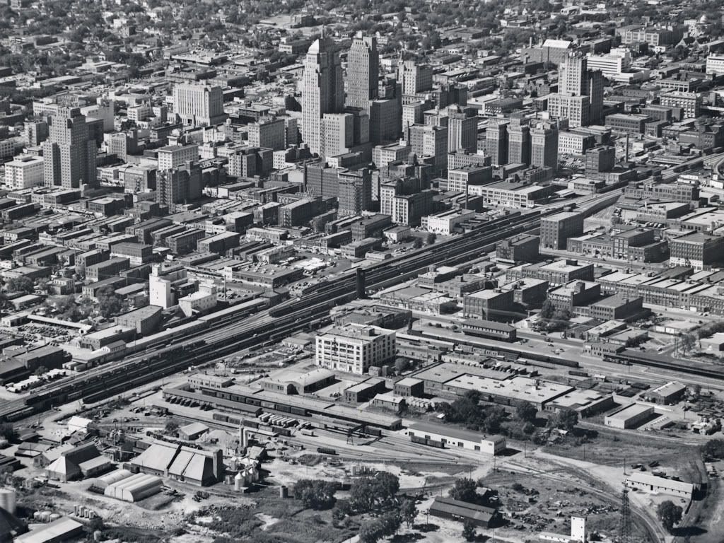
Urban renewal. It's back, and it's in full force. Examine the "main" blunders that OKC made during urban renewal:
-Reconfiguration of the city grid. By removing several streets, making way for superblocks (city blocks that are made up of combined blocks, such as the Cox Center site), and filling them up with single structures we accomplished one thing: We cut off flow from the north side of downtown to the south side of downtown, and as a result, the south side withered away. We cut out large swaths of city and replaced it with dull superblock structures like a convention center, an arena, etc.. and what's even worse, we put them all together. If they were spread around, the edge of the Myriad Gardens would have vitality, the convention center wouldn't be so bad, the Ford Center would be surrounded by retail and restaurants, etc.
-Demolition of existing urban fabric. Here's a shocking concept to most people: A dense city is something that happens naturally, believe it or not. So at the end of the day, after all of these crappy incentives and urban renewal projects, what have we really accomplished? You get more of a downtown that's suited for events and special occasions than for any kind of lifestyle at all, and that's detrimental. Now the incentives are needed because it was unnatural forces that killed most downtowns in the first place (i.e., government subsidizing freeways, roads, cars, white school districts, etc). But when you remove that urban fabric, not only do you remove something that was built specifically for a city to grow into it, but you've severely diminished your ability to bounce back economically.
-Wiping out the architectural and cultural jewels of our city. What's probably the #1 thing that downtown used to be full of that no longer exists in any comparable form or fashion? MOVIES. Vaudeville. Film houses. The only performing arts that exists in downtown anymore are that at the Civic Center Music Hall, which has become a major league performing arts center. The Stage Center hosts a theatrical production once in a blue moon, too, but that's it. There were literally dozens of cultural jewels we have lost. We also lost a lot of our downtown's architectural significance. The result, once you lose all of those things that add intrinsic value to the built environment, is an environment that is not worth caring about to most people.
-Loss of defined space. Believe it or not, well-defined space is another absolutely essential aspect of city development. When people think of the great cities they don't think of one building, but usually it's a street lined with special buildings that build off each other. When people think of these great cities they think of entire environments, not isolated buildings. Defined space, such as a street lined with uniform buildings, also creates natural safety. There is clear definition of the space intended for pedestrians, and you see pedestrians and news stands and more there; there is clear definition of the space intended for cars, and you see cars and bicycles there. When you lose definition you get a downtown environment that behaves more like a stretch of the Northwest Expressway, where there is space for cars, and then the buildings randomly placed, and that's it. You also lose the natural ability to navigate a downtown without a map, which would be possible with a downtown grid that makes SENSE. Today's downtown resembles a space rover trekking through Mars, past unnatural developments like the Century Center and the parking garages along E.K. Gaylord, one-way streets, blocked off streets, streets that dead-end such as Broadway and Harvey and every other street, and so on. It's a nightmare to get around Downtown OKC if you aren't from there!! It just doesn't make sense, there is no defined space, it has not been allowed to develop naturally, and we still don't get that.
-Loss of traditional community uses. Believe it or not the traditional community use of a downtown is not 95% office. Downtowns of olden days were dominated by retail, the thing that is most absent from downtown today! They also had abundant residential units, civic amenities, recreational space, and then there was also a lot of offices. It used to be the beating heart of the city. When we took out the retail districts of downtown, and expected it to relocate to new space that was yet-to-be-built (the planned "Downtown Galleria") we were expecting something unnatural and heavily subsidized to work just as well as the naturally-developing retail district had for decades. That didn't cut it. The result from that blunder was that downtown lost all personal relevance and for a small handful of people that have lived in OKC for a long time, they're still skeptical of going downtown after 5.
So I have gone over some reasons why, specifically, urban renewal was bad. However it obviously doesn't take a rocket scientist or complex explanations for the average pedestrian to tell that urban renewal is bad, all you have to do is experience Downtown OKC today for yourself and you can tell it was not good.
Well looks like we're at it again! And because we have not learned from our own history, we are absolutely doomed to keep repeating the mistakes over and over. Let's go over the main blunders I outlined above, again..

-Reconfiguration of the city grid? Yup, we're definitely at it again. Just look at Core to Shore, particularly the enormous cluster of superblocks beginning at the Cox Center and Myriad Gardens and going all the way down to the new Crosstown. That is a TON of wasted frontage that could be taken up instead by cafes, townhomes, retail storefronts, and other delightful things a downtown SHOULD have. And if the vitality of a city is in the movement of life from one block to another, what is this? There are no blocks here. The Myriad Gardens is an underutilized park surrounded by no significant development that takes advantage of the park front real estate. Likewise, the new Core to Shore park is doomed to the exact same fate, minimized to the point of serving as nothing more than a pretty front yard for the convention center. Instead, why don't we immerse the convention center in the city and surround it on all sides by neighborhoods? It would seem to me that would ensure the success of the park more than anything else!
-Demolition of existing urban fabric? Yeah, we've got tons of that, too! As I wrote the other month in "The problem with an otherwise excellent SandRidge proposal," and in "Building demolition rampant," and countless other posts from before the recent SandRidge proposal, there is a very disturbing trend of tearing down buildings that has come up over the last 5 years. It started with the Brewers who weaseled a demolition proposal through downtown design review mechanisms without anyone ever getting notice of it. Then one day people on their way to work noticed that there was no longer a building standing on East Sheridan, across from the new Hampton Inn. People scratched their heads and wondered, "Wow, how did that happen?" The bottom line is that downtown design review mechanisms have lost any of their effectiveness. The Brewers and others are getting everything from demolition proposals to inflatable dragons in, against "the rules," without ever getting approval from the design review mechanisms intended to prevent that very thing. Sometimes it's because the person filing the permit at City Hall doesn't realize that a signature is missing, other times it's sheer corruption, other times it's sheer incompetence, but most of the time it's a lethal combination of all three things. Today we are witnessing an era in downtown OKC where demolition is championed as "substantial development." How did we get this low?
 -Wiping out the architectural and cultural jewels of our city? Yessir, we've got plenty of that going on as well. Just look at the grand historic KerMac building, a solid building with developers clamoring to renovate it into apartments, with unique architectural detail. It's going to be replaced with a windswept plaza, similar to what already exists all the way around the periphery of the SandRidge Tower. We're also looking at buildings disappearing from Bricktown and MidTown and Automobile Alley. We're also fixing to tear down the India Temple, a building covered by a hideous bland EIFS facade, underneath which is a beautifully detailed and intricate structure. In fact the India Temple was also once home to the State Government during the period after the State Government fled Guthrie and was waiting on the new Capitol Building to be built. That's something we're about to recklessly tear down.
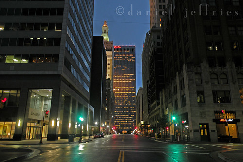 -Loss of defined space? Oh yeah. This is perhaps the most troubling aspect of the "New Urban Renewal" that OKC has set out on, particularly with tearing down one of the last remaining streetwalls in Oklahoma. Out with the old, in with the new, as they say. Downtowns used to be lined uniformly with complimentary buildings. Now all Tulsa has left is Boston Avenue and Main Street. Tulsa's Boston Avenue is by far Oklahoma's greatest street, lined with complimentary highly detailed high-rises as it is, bounded on one end by Oklahoma's tallest skyscraper (for now) and on the other by one of the world's tallest cathedrals, the towering Art-Deco symbol of Tulsa (The Boston Avenue Methodist Church), you could literally drop the unknowing off on Boston Avenue and convince them they are in New York City. OKC really only has three such streetwalls remaining from its once-great downtown: Park Avenue, Harvey Avenue, and Robinson Avenue. Broadway would count too, if its buildings weren't all surrounded by plazas. It is however Robinson Avenue, the least-intact corridor that still resembles some kind of streetwall, that is most endanger due to its proximity to energy giant SandRidge.
Which of these do you like better? Which of the below pictures shows a more defined, urban space? Yeah, tearing down the KerMac bldg will be GREAT for making SandRidge Tower perfectly visible all across downtown--but is that a good thing? Should we be able to look from one block and see straight through to other blocks, and should we HAVE to look at SandRidge Tower everywhere we go in downtown? Those are things worth considering. That's what this is about, is tearing down parts of downtown to make their building more visible. At what cost to the rest of us is that worth it?


-Loss of traditional community uses? Well, you be the judge of that. For what it's worth, we still haven't hardly gotten any meaningful retail going on anywhere in downtown. And all the restaurants are in MidTown or Bricktown. So I would have to say that not only have traditional community uses failed to materialize throughout this "renaissance" of downtown, but in the end we are actually getting ourselves further and further from that ever being realized downtown.
So after all, let me be the first to welcome you to the year 1975. Our mayor is Mick Cornett, our cause is Core to Shore, this message was brought to you by SandRidge Energy, and everywhere else it is the year 2010.
Friday, November 27, 2009
Why should I support MAPS?
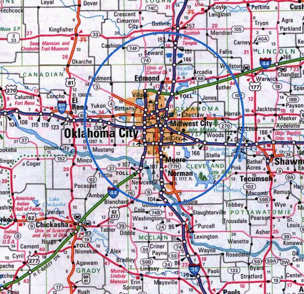 A good question was posed in a comment that I hadn't responded to until now. I saw the comment two days ago and thought it as a great subject to cover in a whole post, so that's why I waited till now to respond. In all honesty, I don't think the subject has been addressed: say you're a suburb person who's still undecided, a family man who has had trouble utilizing downtown fully (i.e., Bricktown isn't the most 'family friendly' place), who prefers to shop in Yukon and Quail Springs, how does MAPS benefit YOU -- why should YOU vote yes on Dec. 8th?
That is a good question.
 While I can come up with a few creative ways to utilize MAPS, some that are probably semantics (like Steve alludes to the pay-to-park areas of Bricktown, when I've never paid for parking in Bricktown in my life), the best reason why such a person's MAPS support is needed is because of what it does for the overall city. Even if someone had might as well live in Edmond or Moore city limits, they should support MAPS for the impact that it has on the entire OKC metropolitan area.
Outlying areas of OKC stand to gain from MAPS in two ways: the quality of life amenities are available to anyone in Central Oklahoma, and the economic impact is enjoyed by everyone in Central Oklahoma. Even if you aren't going to NBA games, attending the symphony, or catching ball games at the Brick, chances are a lot of people in your community are. So the quality of life impact is still in your community, and there are people in your community who will still have the opportunity to take advantage of those things.
 Furthermore, the entire metro area was suffering when OKC was a place "nobody would want to live in." Now that OKC is a desirable metro to live in, the entire Central Oklahoma region benefits from economic expansion. A lot of the economic expansion that's resulted from OKC's raised profile has occurred in the suburbs. While none of these projects are included in the $5 billion economic impact of the $360 million MAPS 1 package (which only includes private investment downtown directly linked to MAPS), they are still a result of economic development initiatives such as MAPS 1. Think of all of the major employers that are now up on Memorial Road, or think of all of the new private sector jobs down by Tinker, or new companies that have set up in Edmond or Norman.
 Will MAPS 3 actually raise the bar for the metro-wide economy? Undoubtedly. The overall focus of MAPS is cumulative, and the projects support each other, so that pet project bickering doesn't defeat any one proposal. Some of the projects, the ones that citizens don't always see themselves using the most, are probably the ones that will actually benefit the economy the most. So in other words, if you're someone who just doesn't come downtown that much, there are still projects that resemble your tax dollars hard at work for you that are benefiting you without having to come downtown. The convention center is the #1 such item. The convention center will be bringing business people to OKC, having them spend dollars generated in another city here in this city, raise OKC's profile in the business world (which will have intangible value), and by having such a state-of-the-art corporate amenity in downtown, it will help us attract more corporations to more their HQs to Oklahoma. More importantly, it will provide resources to help grow Oklahoma-based companies.
Repudiating government
Steve brings up another excellent point: "But now in these tougher economic times where the federal government wants to take more such as forced health insurance with large tax increases- and I really can't do much about it because far left Dems are in charge - I feel this is something I can say no to. It's not "fair" but it's the environment MAPS3 is in."
 I like to think of the different levels of government as being fairly separate, and while the federal government apparently can absolutely ignore the people in a state like Oklahoma, there are governments that can not. State, county, and city governments don't have the same aptitude for criticizing, ignoring, and offending Oklahoma values, because they actually answer to our values (and economic development has traditionally been a Republican priority here). MAPS 3 is Oklahoma City's response to the Stimulus, because the Stimulus did absolutely nothing for us. Maybe MAPS 3 can even be used as an example by the media to make the Stimulus look even worse, when it is enacted and actually fulfils every one of its promises: it will create direct jobs (thousands of construction jobs), it will create indirect jobs (economic expansion), it will improve quality of life, it will leave a lasting impact, it will unify a community much like the first MAPS did, and more.
All of these things it will do because the first MAPS did, all of these things the Stimulus will fall well short of and there's nothing we can do about that, unfortunately. All we can do is take charge of OKC's economy so that we are controlling our own future, so that we never sink to the level of the communities that actually are in the unfortunate predicament of relying on the federal government Stimulus (i.e., places like California and Michigan).
Wednesday, November 25, 2009
MAPS' primary opposition
 Most surprising to me is the turn of events that suddenly MAPS is being attacked from two different sides, taking heat from your run of the mill civic malcontents, and from the police and fire unions who see money up for grabs. Is support for MAPS strong enough to take a battering from two sides?
Every year 2/3 of the General Fund is spent on public safety, in addition to to a 3/4ths of a penny dedicated sales tax (almost the same as the penny MAPS tax) -- together these combine for about $290 million a year spent on public safety in OKC. After we passed the 3/4ths penny sales tax in the early 90s, we became one of the cities with the best-funded public safety in the nation..something we appreciated dearly on April 19, 1995. So that leads us to today, where we must ask ourselves the question, how dare we force the heroes of the Murrah bombing to take a 2% pay cut in order for MAPS 3?
Today most of those cops with beefed up patrols, brand-new equipment, shiny new cars, are being told by the union to put these "Not this MAPS" signs in their front lawns because the fire and police unions want the MAPS penny to go to them. It's union politics at its best. And as for the pay cut, a cop who has been on the force for one year makes over $40,000. Sergeants start at $54,000. Firefighters in OKC make similar salaries, and after several years on the force, make on average around $75,000 a year for a part-time job where they work 4 days out of the week (many have been known to get second jobs). And they are not required to live in the city limits of the city that pays their salary, ether.
For anyone curious about how sales tax in OKC is broken down, this is how:
State: 4.5%
City: 3.875%
2% - General Fund (Permanent)
1% - MAPS penny (Temporary)
.75% - Public Safety (Permanent)
.125% - OKC Zoo (Permanent)
Here's another even more radical concept: the MAPS penny and public safety are two completely unrelated subjects altogether. The police and fire unions, who want more money after the City wants to cut back on their 2% raises this year, are just sticking it to the city where it hurts them the most, the MAPS campaign.. unfortunately the collateral damage is the city that they are sworn to protect. The truth is that not having a 2% raise is a lot better than the rest of the city departments are getting, so public safety is lucky in all honesty. If I were Jim Couch I would actually cut their budget. Other departments are going through hiring freezes, some workers have been laid off, albeit not nearly as sharply as has happened in other cities. The fact of the matter is that municipal governments have to stay out of the red just as much as any company does, and sometimes that effects the workers.
The city government can't just get China to buy its debt like the Federal government can, but on the bright side at least China doesn't literally own Oklahoma City.
More blatantly appalling is that MAPS funds are entirely separate from the General Fund or from dedicated public safety funds, and trying to distort the issue so that tax payers will think that MAPS will somehow worsen the shortfall for public safety is bad. And it's unethical, from a public policy perspective, and I just hope OKC voters aren't stupid enough to be had by the unions. I guess when you're a union ethics just go out the window, though. How do we know for a fact that the union is just using MAPS as a bargaining chip with the city? Read this:
 They say they want two things: they want their contract issues resolved, and they want the MAPS items to stand on their own for election. Which one do they really want? Probably their contract issues to be resolved so they can collect their 2% raise before the Holidays. Do they care if the MAPS items stand on their own? Probably not (unless they still want that MAPS money for themselves after they get their raise), if so, why? Why are the police and fire unions even caring to get involved in public debates over completely unrelated issues? Should we start consulting the police and fire unions on how to fund schools, roads, and other things as well? What is the official union position on gay marriage, abortion, and teaching evolution in the schools? Have the unions written an entire voter's manual telling cops and firefighters who to vote into office? The answer is that all of those questions are preposterous, just as their involvement in MAPS 3 is.
If OKC fails MAPS 3, has public safety in OKC benefited? No, it hasn't, in fact, it harms public safety. If OKC doesn't continue MAPS and sinks into a decline anywhere near as low as before MAPS, the reality is that our public safety issues just multiply. OKC should evaluate whether there are enough cops on the force, but even with that said, it's very untrue that numbers haven't increased in the last 15 years. And more, if they can't live with being one of the few forces in the nation that have a dedicated funding source, then they need to examine their budget for a change.
Also public safety would be conning their ownselves out of the $60 million in use taxes that they collect from MAPS. The use tax is the same as the MAPS tax rate, except it is applied to items brought into OKC and not bought directly in OKC, and the MAPS penny collected on use items has always gone straight to public safety.
Blackmail is the oldest trick in the book. "Pay us and nothing bad will happen. Don't pay us, well, you don't want to not pay us."
Thursday, November 19, 2009
Devon skyline views
With Devon well under way, and anticipation pent up for completion of the 850 foot tall tower in 3 years, a lot of people have done mockups of what Devon will look like in the skyline. The best I have seen come from Shane Hampton over at rezoneOKC.com.
One series uses Google Earth, and the other series just photoshops it into a photograph taken from Fair Park.
 Before
 After
After
From Google Earth:
 From St. Anthony's
 From North Broadway
 From the Oklahoma Health Center
 From the Bricktown Ballpark
Of course I think for the Google Earth renderings, that the tower might be too slender.. it will actually have a larger footprint than the Oklahoma Tower, whereas in many of the Google Earth images it appeared as if the Oklahoma Tower had a lot more girth. So these are off a little bit, but it's still an interesting illustration. For full size pics check out Shane's blog at rezoneOKC, as well as his in-progress development charts.
One series uses Google Earth, and the other series just photoshops it into a photograph taken from Fair Park.
From Fair Park:
BeforeAfterFrom Google Earth:
From St. Anthony'sFrom North BroadwayFrom the Oklahoma Health CenterFrom the Bricktown BallparkOf course I think for the Google Earth renderings, that the tower might be too slender.. it will actually have a larger footprint than the Oklahoma Tower, whereas in many of the Google Earth images it appeared as if the Oklahoma Tower had a lot more girth. So these are off a little bit, but it's still an interesting illustration. For full size pics check out Shane's blog at rezoneOKC, as well as his in-progress development charts.
Wednesday, November 18, 2009
Bring on a new game changer
 Game changers enter the picture and come downtown every other month now it seems, which is great considering the recession. MAPS 3 one month, Myriad Gardens renovation plans come out the next month, Devon breaks ground the next month, fast forward, and now we have a new potential game changer. And even though it seems like not long ago OCU had finished the Sarkeys Law Center, Fred Jones Hall just recently announced that his family's downtown building, the old Fred Jones plant, will soon become the new OCU Law School--which will be a $30-50 million renovation project.
Downtown has long been a montage with doctors on the east, and lawyers on the west. I would say a majority of Oklahoma City attorneys office on the west side of downtown due to its proximity to the County Jail and the old Courthouse, not to mention other attorneys and various legal services. Now OCU announced they're looking to get their law school in the fray of things, and they've gotten more certain about it with one added caveat: IF MAPS 3 passes.
 So now MAPS 3 has to pass, and it's already gained what I like to call "an impact guarantee." When people pass public initiatives they like to be able to look back and say that it's had impact. We look back on the original MAPS and say it had a $5 billion impact on downtown. We'd like to be able to look back on MAPS 3 and say it had a similarly huge impact on downtown, which it will. But we can do one better--now we have groups promising to move downtown if MAPS 3 passes, so we can anticipate exactly what some of that impact will be: OCU Law moving downtown, into the old Fred Jones plant--a building I've always been fond of.
And then the reason that OCU Law could be a potential game changer is what it adds to a growing education sector that's downtown. Between the ACM@UCO and OCU Law, downtown will have at least 2,000 college students. With that should come housing that students can afford, restaurants and coffee shops students will want, and more. Also should downtown pass a threshold of 2,000 students, it's likely that other schools might be attracted to move into downtown. It also ruled out the Fred Jones plant as the future home for the ACM, which will have to look at expanding somewhere else.
Add into the mix all of the medical students at the OU Health Sciences Center in the Oklahoma Health Center just east of downtown and the picture starts to get big. Graduate students will be a very big part of downtown's future, and the OUHSC is still growing rapidly as well. The mix is diverse, and big. The possibilities are varied. In downtown Indianapolis there's a large college consortium shared by Indiana University and Purdue University--the two big state schools in Indiana. The IUPUI campus (Indiana-Purdue Indianapolis) itself has 22,000 undergrad students, 30,000 including grad students, and a $600 million endowment separate from IU or Purdue. To illustrate the impact IUPUI has had on downtown Indy, they recently just finished a $1 billion building campaign. I know OKC leaders have spent a lot of time in Indy studying what they've done with sports and the convention industry, but they should look at what they've doen with higher education as well.
Tuesday, July 14, 2009
Alternative C2S vision...closer to 20/20
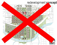
I've made an alternate proposal for C2S, which I created simply using paint basically in all of 1 hour. To be honest, I could spend an hour each night and come up with a different one, all of them probably making more sense than the existing C2S proposal. My point isn't to say this is what I want C2S to look like, but rather, just to throw out some other ideas. That's what's lacking, is alternative ideas flowing. Without further ado, here's what I came up with:

You should be able to click on it and get a bigger version if you need. But in all, I feel like this is a much better proposal for how to do C2S than what we currently have. The key differences I think are that the green space is continuous, the boulevard is a little toned down, the convention center is moved to its own little district by the head of the Bricktown Canal, the canal extension follows Sheridan instead of cutting C2S off from the CBD, and it includes a streetcar route that cuts through the area. I think I also put a lot more emphasis on the concept of "live/work/play".
South of there, there is a historic preservation district along SW 3rd. Brick warehouses that can be converted to lofts, light retail, coffeeshops, and restaurants. On the other side of this historic preservation area is a predominantly residential area that is dense, yet also quiet at the same time. This is actually intended to be a really upscale neighborhood centered around Central Park. Or Center City Park. Or something like that. The idea is that it is an upscale neighborhood built around a park that really reflects heavily on being in the middle of a cosmopolitan city, which is why I felt like naming it Central Park over the main park, which I wanted to have a more unique name that doesn't scream, "We're a midsize metro trying to replicate New York." Closer to the main park (on the east side of this district) is a more mixed-use area. The mixed-use zoning isn't to indicate mass new urbanist development, but more just that the street levels of all of the buildings won't be residential. They'll include stuff like bookstores, cafes, coffee shops, night clubs, maybe small bank branches, dry cleaners, fast food, etc. It will be the area where basic neighborhood retail is concentrated, but this area is still predominantly residential, and upscale, just like the western half of the district. Buildings for the entire area, from Western to park edge, will have a maximum height of 5 stories.
Across the Crosstown Expressway from the area I just described is a more middle class residential neighborhood that isn't nearly as mixed-use as the area fronting the Myriad Commons north of the Crosstown. There might be an occasional street level coffee shop or cafe, but here there's nothing wrong with street-level homes. This area is really dense, but also has a height restriction of 5 stories. The neighborhood is anchored by the community center proposed for the park and by the Little Flower Church. Maybe there could be some other churches, as long as the modern churches could build on a site that mirrors historic urban churches. South of 12th street is just an area (that is still pretty dense) that consists of single family bungalow homes with small yards. Imagine a modern Jefferson Park.
Across the park (on the SE side of the park) is a mixed-bag neighborhood. It's basically a mix between SW and NW parkside. It'll be home to both middle class, lower-middle class, and upscale, and it will mostly be a quiet residential-dominated neighborhood, with the exception that some blocks adapt to special environments. For instance along SW 10th Street where I proposed for the streetcar to cut through the park, is an area of moderate mixed-use development with uses that correlate to the massive new convention center, just up the streetcar line. The area is lined with hotels and mixed-use development, BUT it still tries to keep a subdued, mostly residential feel to the area. The subdued feeling ends at 5th Street where there will be mixed-use development along Ellison, right across from what will become the new front entrance of the Ford Center. I believe that this area should be heavily oriented around the Ford Center. Maybe include an ESPN Gameday, sports bars, and fan shops. The development will be similar to the Power & Light District in Kansas City, which won't be as dense as the development further west along Ellison, but it will still have an active and hectic feel with pedestrians all around and street parking near impossible to find. Maximum height maybe..3 stories tall in this area, but still dense, and no surface parking, which should go without saying. This gamezone area is the least dense area I've planned, but at the same time one of the busiest. The absolute KEY to this area is that Shields Blvd HAS to be redone! It needs to be brought down to the street level.
In the convention center district the idea is that this area is busy, absolutely hectic. I was worried that the convention center might dull down on days without conventions in town, so I put it across Ellison from Lower Bricktown and surrounded it with sort of a "Lower-Lower Bricktown". Hopefully the area is a hit. Ellison, the way I want it, will be very easy to walk across on foot, so the idea is for this area to basically be part of Bricktown. Or Lower Bricktown, at least. A key thing I want to mention about the convention center is that I put it on top of the grain silo for a reason. Everything that isn't colored blue can just be razed, but I would really like it if the City of OKC would preserve those grain silos and include OKC Rocks, grain silo and all, in the convention center site. The result could be a really cool contrast between OKC's roots and OKC's future and a design that is so creative and unique it becomes megalomania in the architecture world.
Across the Crosstown is another park-oriented neighborhood that is nothing special. The idea is that Regatta Park is going to become one of OKC's biggest and most important attracts, so I just wanted it to be very incorporated into the urban fabric, which right now it hardly is. On the east side the density starts up high and then turns into dense bungalows, similarly to on the across corner of C2S. The bungalows will back up to the existing Kerr McGee tower thingy that I forget what it is at the moment (because it is so forgettable). On the other side of Regatta Park is a denser, more middle-class neighborhood that probably is more influenced by being waterfront than parkfront. Along the riverfront is room for a corporate tenant to do something unique and modernist. In fact there are scattered nodes all along the riverfront in various spots, I think 3 or 4, that will be small corporate campuses, except for one big one at the Walker bridge. This is just to have a lot of architectural diversity along the river, considering that corporate campuses usually feature what's "cutting-edge" for the time, which at the present, is anything that looks LEED-certified. You won't get that from residential neighborhoods for the most part. There's a boardwalk where people can set up vending stands and stuff by the 15th Street bridge (which can just be gotten rid of IMO, as I was careful to make sure I didn't include it in my planning) and another pocket park along the river at 11th, which will just be a nice little square with fountains and statues and stuff.
Phwew! That's an exhausting overview of something different that we can do with C2S. Oh and last but not last, I included the Humphreys airpark redeveloment site (which will actually be the first of any of this to break ground), and I had an idea that the West Reno streetcar line might be able to be extended south along Western so that it could service what will be a major development here along the river. It might just be a better idea though to save that, not for the downtown streetcar circulator system, but for when its time to start on city-wide light rail (different from streetcar). The line extending south or whatever could pass it somehow. Just a thought.
Hope you all liked this, or read it at least. Let me know what you think!

You should be able to click on it and get a bigger version if you need. But in all, I feel like this is a much better proposal for how to do C2S than what we currently have. The key differences I think are that the green space is continuous, the boulevard is a little toned down, the convention center is moved to its own little district by the head of the Bricktown Canal, the canal extension follows Sheridan instead of cutting C2S off from the CBD, and it includes a streetcar route that cuts through the area. I think I also put a lot more emphasis on the concept of "live/work/play".
- The convention center being moved, I feel, is the most important change I made. I hate the current site because it creates an impenetrable cluster of superblock civic buildings all the way from Sheridan down to the new Crosstown. By moving it across Shields it's now right across the street from Bricktown and less likely to create a huge vacuum of normal live/work/play use in the heart of C2S. But I also didn't want to move the convention center and end up segregating it so that it doesn't feel like a part of the city, so I really gave it its own little mixed-use district, that is mostly going to be geared toward hospitality, but deeper in will also include residential. I felt like it worked out perfectly that the convention center and the new district built up around it will surround the headwaters of the Bricktown Canal, which connects it into Bricktown for sure and will end up creating interesting development opportunities.
- Another key change is the boulevard, which I aptly named Ralph Ellison Avenue, after OKC's famed author who largely gets no recognition from the community. The boulevard represents a compromise between one faction that wants a soaringly wide, amazing, landmark stretch similar to the Champs Ellyses in Paris, and another that is more pragmatic about the likelihood that such a soaringly wide boulevard would ruin C2S. I propose two simple one-way streets that are two lanes with side parking on the outside (so really 3 lanes wide) that are separated by a wide median. Effectively, it's one street--but it is separated so that there is a wide right of way that can be used to expand should the pedestrian activity ever guarantee that a wide avenue wouldn't be a flop..but at the same time I want it to be an important artery because it is the street that will take people all the way across the center city. Hopefully tourists and travelers will make the choice to take the exit and wind up back on the highway which will show off our awesome city. By having the median park, which would have benches, fountains, walking trails, etc, and keeping the vehicular streets narrow, hopefully the environment would retain walkability so that it isn't keeping the Mongols out or something.
- I also feel differently about how the park should be planned. I think it's completely stupid to have one block that's developed as a shopping mall separating the Myriad Gardens from the elongated Central Park. It's absolutely moronic in my opinion. I moved the shopping mall (which isn't really a shopping mall, but sorta-kinda) to where the convention center currently is and proposed another such major mixed-use development on the west edge of the park along Ellison, which I'll discuss more in detail later. The way I envision it, the closest expansion zone (which is currently slated as shopping mall) should most closely resemble the existing Myriad Gardens which was never finished. Here I would simply finish the Myriad Gardens with the things that I.M. Pei planned for it to have (say what you want about the misguidedness of Pei's comprehensive plan, the Myriad Gardens are the one great thing that we got out of it). Going further down across Ellison the park can exactly resemble the design proposed by the official C2S oversight committee. I have no problem with the amenities of the proposed park! It would be Central Park NYC mixed with elements of Millennium Park Chicago, but it would all be one cohesive landmark park all the way from across the Devon Tower to the shore of the Oklahoma River, but it would just be named the Myriad Commons.
There would also be a Central Park, but it would be much smaller, and less landmark. Central Park would be a small neighborhood-oriented park to build the parkside neighborhood around. It would still be a decently sized park though, but it would be much cheaper because it would require no interesting features. Just some walking trails and tons of landscaping would be perfect there. One idea I'd love to see explored a lot more in OKC is community gardening. Maybe they can fence off an area, or heck the entire park, and divide it into community gardens that people can rent as their own for a very small fee.
 The Bricktown Canal extension should go along Sheridan, and not the boulevard. Sheridan would still go through, but for those two blocks between the edge of Bricktown and the Myriad Gardens, which mostly passes the bulk of our little "hotel district", it would be one-way entering Bricktown. The west-bound side would be taken out and that's where the Canal extension would go. The existing sidewalk for Sheridan and Sheridan Avenue itself would be the walkways along it. This would be the easiest way to extend the Canal west, and as long as Sheridan can still provide ingress to Bricktown then it works out perfectly. A walkable and attractive right-of-way is created that pedestrians can use to perfectly navigate between the CBD and Bricktown, namely, from Bricktown restaurants to the Ford Center or other attractions, with existing hotels positioned strategically. Maybe the Century Center can even be torn down and developed with a new hotel along the extended Canal. Extending the Canal specifically down Sheridan, which would line it with hotels, the old convention center, the park, and Devon Tower, it's a canal that does a better job of holding a candle to the San Antonio Riverwalk.

 Other less key differences: I created a historic preservation area for Film Row (which doesn't deviate from the current plan, but I just felt like it should be included since the area borders the C2S impact zone) and also one for SW 3rd Street which does deviate greatly from the current plan. There are a lot of really awesome historic brick warehouses along SW 3rd that should be saved and converted to mixed-uses somehow. This zone would encourage that to be done. Also the streetcar goes down Walker, cuts across the park south of I-40 (although doing it at I-40 might be a better idea in hindsight), and then goes up the existing BNSF tracks where it will have stops at the new convention center, Bricktown, and northward from there. Along the river, south of Regatta Park (where amazing things are happening) I added a residential district that will have a boardwalk on the south end, and at the heart of the residential riverfrontage is a little monument park which would have statues and fountains and stuff.

South of there, there is a historic preservation district along SW 3rd. Brick warehouses that can be converted to lofts, light retail, coffeeshops, and restaurants. On the other side of this historic preservation area is a predominantly residential area that is dense, yet also quiet at the same time. This is actually intended to be a really upscale neighborhood centered around Central Park. Or Center City Park. Or something like that. The idea is that it is an upscale neighborhood built around a park that really reflects heavily on being in the middle of a cosmopolitan city, which is why I felt like naming it Central Park over the main park, which I wanted to have a more unique name that doesn't scream, "We're a midsize metro trying to replicate New York." Closer to the main park (on the east side of this district) is a more mixed-use area. The mixed-use zoning isn't to indicate mass new urbanist development, but more just that the street levels of all of the buildings won't be residential. They'll include stuff like bookstores, cafes, coffee shops, night clubs, maybe small bank branches, dry cleaners, fast food, etc. It will be the area where basic neighborhood retail is concentrated, but this area is still predominantly residential, and upscale, just like the western half of the district. Buildings for the entire area, from Western to park edge, will have a maximum height of 5 stories.
Across the Crosstown Expressway from the area I just described is a more middle class residential neighborhood that isn't nearly as mixed-use as the area fronting the Myriad Commons north of the Crosstown. There might be an occasional street level coffee shop or cafe, but here there's nothing wrong with street-level homes. This area is really dense, but also has a height restriction of 5 stories. The neighborhood is anchored by the community center proposed for the park and by the Little Flower Church. Maybe there could be some other churches, as long as the modern churches could build on a site that mirrors historic urban churches. South of 12th street is just an area (that is still pretty dense) that consists of single family bungalow homes with small yards. Imagine a modern Jefferson Park.
Across the park (on the SE side of the park) is a mixed-bag neighborhood. It's basically a mix between SW and NW parkside. It'll be home to both middle class, lower-middle class, and upscale, and it will mostly be a quiet residential-dominated neighborhood, with the exception that some blocks adapt to special environments. For instance along SW 10th Street where I proposed for the streetcar to cut through the park, is an area of moderate mixed-use development with uses that correlate to the massive new convention center, just up the streetcar line. The area is lined with hotels and mixed-use development, BUT it still tries to keep a subdued, mostly residential feel to the area. The subdued feeling ends at 5th Street where there will be mixed-use development along Ellison, right across from what will become the new front entrance of the Ford Center. I believe that this area should be heavily oriented around the Ford Center. Maybe include an ESPN Gameday, sports bars, and fan shops. The development will be similar to the Power & Light District in Kansas City, which won't be as dense as the development further west along Ellison, but it will still have an active and hectic feel with pedestrians all around and street parking near impossible to find. Maximum height maybe..3 stories tall in this area, but still dense, and no surface parking, which should go without saying. This gamezone area is the least dense area I've planned, but at the same time one of the busiest. The absolute KEY to this area is that Shields Blvd HAS to be redone! It needs to be brought down to the street level.
In the convention center district the idea is that this area is busy, absolutely hectic. I was worried that the convention center might dull down on days without conventions in town, so I put it across Ellison from Lower Bricktown and surrounded it with sort of a "Lower-Lower Bricktown". Hopefully the area is a hit. Ellison, the way I want it, will be very easy to walk across on foot, so the idea is for this area to basically be part of Bricktown. Or Lower Bricktown, at least. A key thing I want to mention about the convention center is that I put it on top of the grain silo for a reason. Everything that isn't colored blue can just be razed, but I would really like it if the City of OKC would preserve those grain silos and include OKC Rocks, grain silo and all, in the convention center site. The result could be a really cool contrast between OKC's roots and OKC's future and a design that is so creative and unique it becomes megalomania in the architecture world.
Across the Crosstown is another park-oriented neighborhood that is nothing special. The idea is that Regatta Park is going to become one of OKC's biggest and most important attracts, so I just wanted it to be very incorporated into the urban fabric, which right now it hardly is. On the east side the density starts up high and then turns into dense bungalows, similarly to on the across corner of C2S. The bungalows will back up to the existing Kerr McGee tower thingy that I forget what it is at the moment (because it is so forgettable). On the other side of Regatta Park is a denser, more middle-class neighborhood that probably is more influenced by being waterfront than parkfront. Along the riverfront is room for a corporate tenant to do something unique and modernist. In fact there are scattered nodes all along the riverfront in various spots, I think 3 or 4, that will be small corporate campuses, except for one big one at the Walker bridge. This is just to have a lot of architectural diversity along the river, considering that corporate campuses usually feature what's "cutting-edge" for the time, which at the present, is anything that looks LEED-certified. You won't get that from residential neighborhoods for the most part. There's a boardwalk where people can set up vending stands and stuff by the 15th Street bridge (which can just be gotten rid of IMO, as I was careful to make sure I didn't include it in my planning) and another pocket park along the river at 11th, which will just be a nice little square with fountains and statues and stuff.
Phwew! That's an exhausting overview of something different that we can do with C2S. Oh and last but not last, I included the Humphreys airpark redeveloment site (which will actually be the first of any of this to break ground), and I had an idea that the West Reno streetcar line might be able to be extended south along Western so that it could service what will be a major development here along the river. It might just be a better idea though to save that, not for the downtown streetcar circulator system, but for when its time to start on city-wide light rail (different from streetcar). The line extending south or whatever could pass it somehow. Just a thought.
Hope you all liked this, or read it at least. Let me know what you think!
Wednesday, August 6, 2008
Core to Shore Lofts?
For those who don't believe we will see much impact yet in terms of real development from Core to Shore, this post is for you. Because, hearken, you are about to be proved wrong.
As I was checking Google for anything new on C2S I was a little surprised when I came across a Sperry Van Ness commercial listing for a circa 1919 4-story brick warehouse building off Shields that is being pitched as a perfect site for lofts. The 56,000 SF building and adjacent 30,000 SF warehouse is being marketed for the pretty penny of $4.25 million. I've always thought this building would be a good fit for some pretty cool lofts. So I was glad to see that there's some lofty activity going on in the area already.
The listing mentions the pristine site, and how the area is being revitalized for new offices, retail, and lots and lots of lofts. Unfortunately the listing fails to mention the convention center proposed for C2S. Any guesses why?
Monday, August 4, 2008
Mum's the word on the Colcord
In March Devon made history in OKC by announcing the undertaking to build a skyscraper that will become a new symbol of a city that has outgrown its comfortable symbols, and one that will not only be the city's tallest, but surely the entire State's, and believe it or not (@ incessant Oklahoma detractors), that's saying something. The state's 4 tallest buildings, all in Tulsa, range from 514-663 feet, which is far taller than anything in most states our size (SC and OR are closest in size). But skyscrapers in both OKC and Tulsa got a much humbler start, as they did everywhere they are found. The first skyscraper ever proposed in Oklahoma was the 12-story Chicago School-style building at the corner of Robinson and Sheridan. Interestingly enough the Colcord Building was planned by Charles Colcord to be a hotel, and while it began construction 2 years after statehood in 1909, it wasn't until being redeveloped in 2006 that it actually became a hotel.
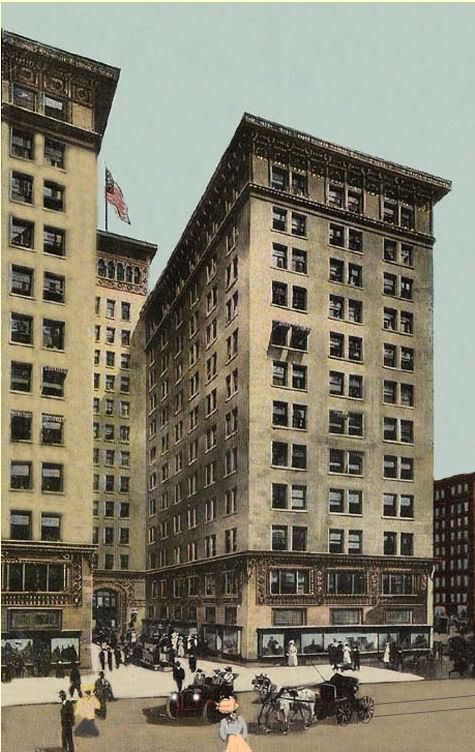 Furthermore the 12-story hotel building was originally planned to have a 'Phase 2' of construction during which the L-shaped building would be a U-shaped one, as shown in this rendering (from Doug's blog).
Today Devon Energy Corp announced that they are purchasing the Colcord Tower and that it will be incorporated into their new mixed-use headquarters campus that will break ground later this year, and change more than just OKC's skyline for quite a while. While mum is the word on their official plans, the following are evident:
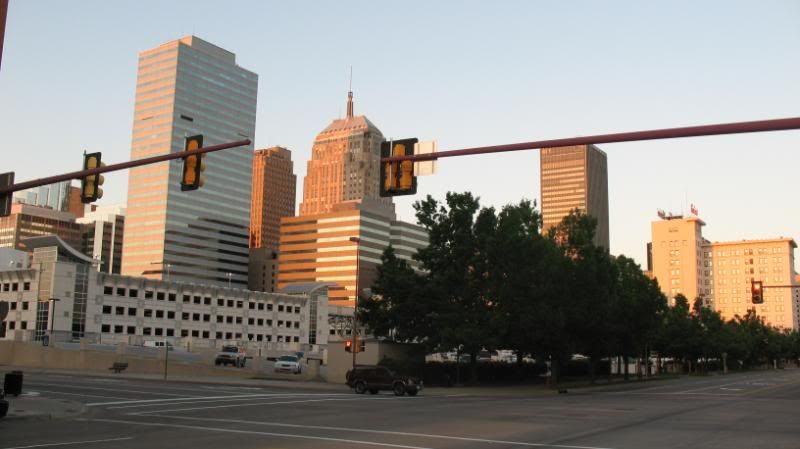 Now IMAGINE, for a second, the new Devon headquarters at this site. Imagine a 700-footer here at this corner, complete with the things I mentioned above, plus only the best in corporate creature comforts (employee food court, gym, etc) and what he's described as what will be "Oklahoma's grandest lobby" (though nothing will ever be as grand as the Art-Deco Great Banking Hall of the historic First National). Imagine an iconic plaza where the tower meets the Gardens, which you must imagine after significant Devon-funded improvements. Now imagine the U-shape of the Colcord finally coming to fruition. The construction could try to closely match the existing half (and show Bricktown a thing or two) or it could go contemporary, for contrast, which would be better for actually incorporating the Colcord into the site plan.
The benefits of incorporating the Colcord into the Devon's headquarters site plan could be incredible. For one, Devon could further impact downtown, especially the area surrounding the park. All of downtown's corporations benefit if downtown gets something it desperately needs, which right now, downtown needs to bump up its hotel count dramatically as it soldiers on toward becoming a Tier 2 city. More directly this gives Devon a place to lodge visiting employees, shareholders, public officials, etc., and with the excess rooms, Devon can use them to make partnership deals with other local partners of theirs. We know cross-town rival, Chesapeake Energy would scoff at the suggestion, but there are probably over a hundred energy companies located downtown, and Devon has to be on friendly terms with some of them!
Furthermore the 12-story hotel building was originally planned to have a 'Phase 2' of construction during which the L-shaped building would be a U-shaped one, as shown in this rendering (from Doug's blog).Today Devon Energy Corp announced that they are purchasing the Colcord Tower and that it will be incorporated into their new mixed-use headquarters campus that will break ground later this year, and change more than just OKC's skyline for quite a while. While mum is the word on their official plans, the following are evident:
- It will be an integral part of their corporate headquarters
- It will remain open during construction on the tower
- Devon clearly has a unique opportunity with the Colcord
- The Colcord was never actually completed
- The building will remain an upscale boutique hotel
Now IMAGINE, for a second, the new Devon headquarters at this site. Imagine a 700-footer here at this corner, complete with the things I mentioned above, plus only the best in corporate creature comforts (employee food court, gym, etc) and what he's described as what will be "Oklahoma's grandest lobby" (though nothing will ever be as grand as the Art-Deco Great Banking Hall of the historic First National). Imagine an iconic plaza where the tower meets the Gardens, which you must imagine after significant Devon-funded improvements. Now imagine the U-shape of the Colcord finally coming to fruition. The construction could try to closely match the existing half (and show Bricktown a thing or two) or it could go contemporary, for contrast, which would be better for actually incorporating the Colcord into the site plan.The benefits of incorporating the Colcord into the Devon's headquarters site plan could be incredible. For one, Devon could further impact downtown, especially the area surrounding the park. All of downtown's corporations benefit if downtown gets something it desperately needs, which right now, downtown needs to bump up its hotel count dramatically as it soldiers on toward becoming a Tier 2 city. More directly this gives Devon a place to lodge visiting employees, shareholders, public officials, etc., and with the excess rooms, Devon can use them to make partnership deals with other local partners of theirs. We know cross-town rival, Chesapeake Energy would scoff at the suggestion, but there are probably over a hundred energy companies located downtown, and Devon has to be on friendly terms with some of them!
Sunday, August 3, 2008

Subscribe to:
Posts (Atom)